Quantcast
ZME Science
  • News
  • Environment
  • Health
  • Future
  • Space
  • Features
  • More
    • About
    • The Team
    • Advertise
    • Contribute
    • Our stance on climate change
    • Privacy Policy
    • Contact
No Result
View All Result
ZME Science

No Result
View All Result
ZME Science
No Result
View All Result
Home Science News

Wildfires roar through Southern Cali as NASA and ESA satellites watch, powerless to intervene

Immense devastation has been wrought upon California this year.

Alexandru Micu by Alexandru Micu
December 8, 2017
in News, Space
Reading Time: 2 mins read
A A
Share on FacebookShare on TwitterSubmit to Reddit

The scope and destructiveness of Southern California’s wildfires were captured in chilling detail by ESA satellites earlier this week.

Ventura wildfires.
Image via DailyDot.

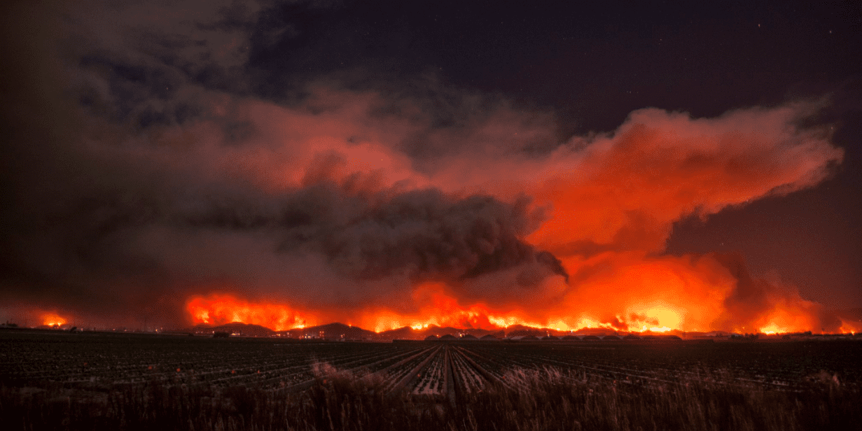
Wildfires have turned large swaths of California into a Mordoresque landscape over the last few months, but flames won’t seem to spare the golden state. Dramatic pictures of the most recent blaze to erupt in Southern California were captured by the European Space Agency’s Sentinel-2 spacecraft on Tuesday, Dec. 5, revealing areas of active fires and a massive burn scar a stone throw’s away from the city of Ventura.
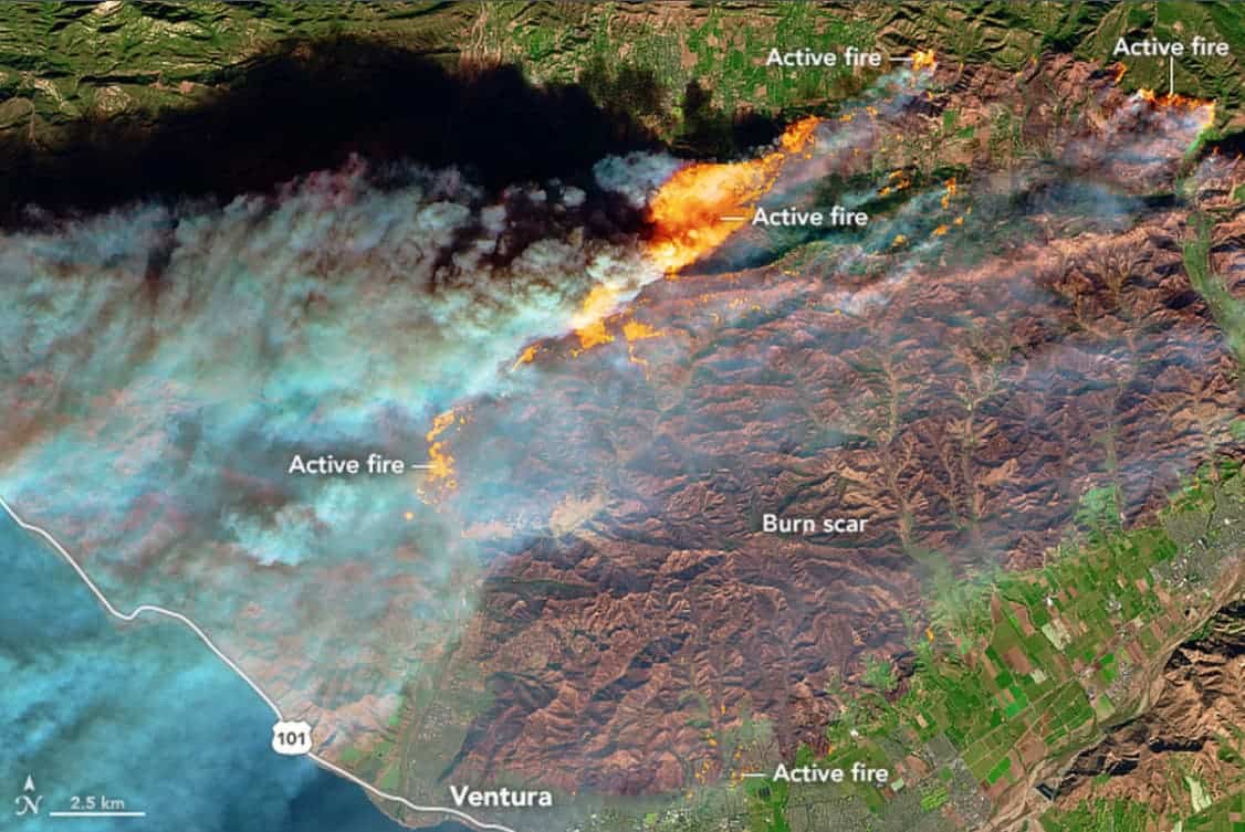
Wildfires Ventura ESA.
Massive burn scar just east of the California city of Ventura, along with areas of active fires.
Image credits ESA.

Sentinel-2’s photo captures billowing smoke rising from the areas of active fires. The same can be seen in another image captured Tuesday by the Moderate Resolution Imaging Spectroradiometer (MODIS) instrument aboard the Terra satellite operated by NASA. MODIS took a wider view than the instruments on Sentinel-2, showcasing the tsunami of smoke flowing west, from Ventura and north Los Angeles’s hills into the Pacific Ocean.
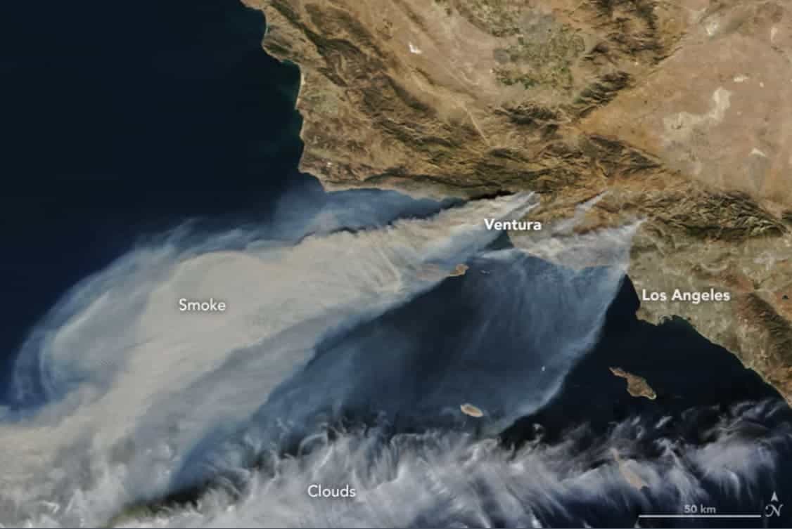
ADVERTISEMENT
Wildfires Cali NASA.
Image captured by the MODIS instrument aboard NASA’s Terra satellite shows smoke plumes rising from the Southern California wildfires.
Image credits NASA.

The Ventura fires first caught Monday and spread with a fury due to Southern California’s Santa Ana winds. As of data available on Wednesday afternoon, the flames have burned through 83,000 acres (33,600 hectares), CNN reports. Just this October, Northern California was ravaged by wildfires which cindered 245,000 acres (99,150 hectares), more than 8,900 houses and other buildings, and claimed over 40 lives.

Sorry to interrupt, but you should really...

...Join the ZME newsletter for amazing science news, features, and exclusive scoops. More than 40,000 subscribers can't be wrong.


ADVERTISEMENT

Tags: esaMODISnasaSourthern CaliforniaVenturaWildfires
Share10TweetShare
Alexandru Micu

Alexandru Micu

Stunningly charming pun connoisseur, I have been fascinated by the world around me since I first laid eyes on it. Always curious, I'm just having a little fun with some very serious science.

ADVERTISEMENT
ADVERTISEMENT
  • News
  • Environment
  • Health
  • Future
  • Space
  • Features
  • More

© 2007-2019 ZME Science - Not exactly rocket science. All Rights Reserved.

No Result
View All Result
  • News
  • Environment
  • Health
  • Future
  • Space
  • Features
  • More
    • About
    • The Team
    • Advertise
    • Contribute
    • Our stance on climate change
    • Privacy Policy
    • Contact

© 2007-2019 ZME Science - Not exactly rocket science. All Rights Reserved.