If you want to feel like an astronaut from the comfort of your home, Google has you covered.

Astronauts aboard the International Space Station have helped Google capture 360-degree panoramas of the insides of the ISS modules, capturing some dazzling views of Earth in the process. You can view it just like a regular Streetview, by accessing the Planets Page of Google Maps.

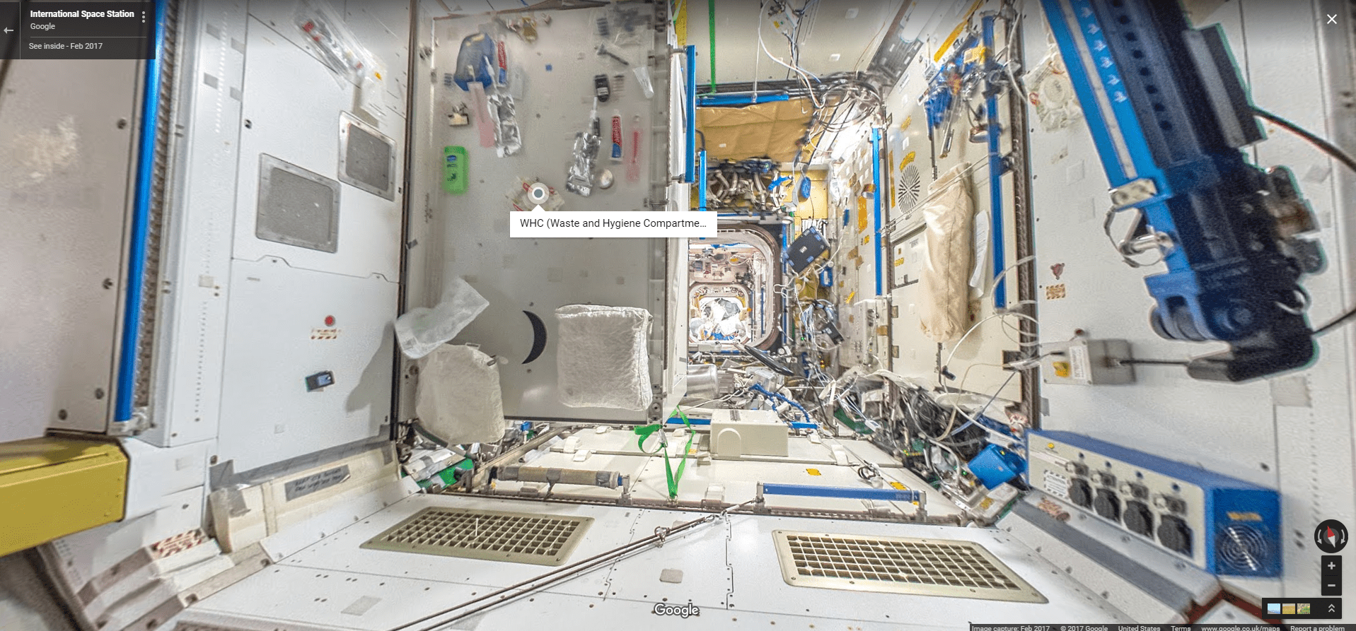
This creative project required a creative approach. For instance, on Earth, you’d just use a tripod and snap 360 pics… but that’s not so easy on the ISS. In space there are no tripods, so they ended up using a pair of crisscrossing bungee chords. They then took photos at several different angles, with 24 photos being necessary for a full 360-degree view. There were also a lot of obstacles, and of course, astronauts had plenty of other work to do.
Overall, you can view the station’s 15 modules, accompanied background information about the equipment on display. This information is vital because it helps make sense of the apparent chaos.
It’s an interesting and educational experience, one which Google and NASA hope will raise interest for space exploration and research. After all, the International Space Station is the most complex and expensive object mankind has built, and it’s greatly benefitting science every single day. Hopefully, it will continue to do so for years to come.
This is the first extra-terrestrial Street View has ever gone. Google has gone to some special places before, such as Australia’s Great Barrier Reef and elevated sights from Peru’s Machu Picchu citadel — but those involved transporting a specialist with special equipment. This wasn’t possible on the ISS, so astronauts had to do the task themselves. They reportedly did quite a bit of troubleshooting before releasing the final images.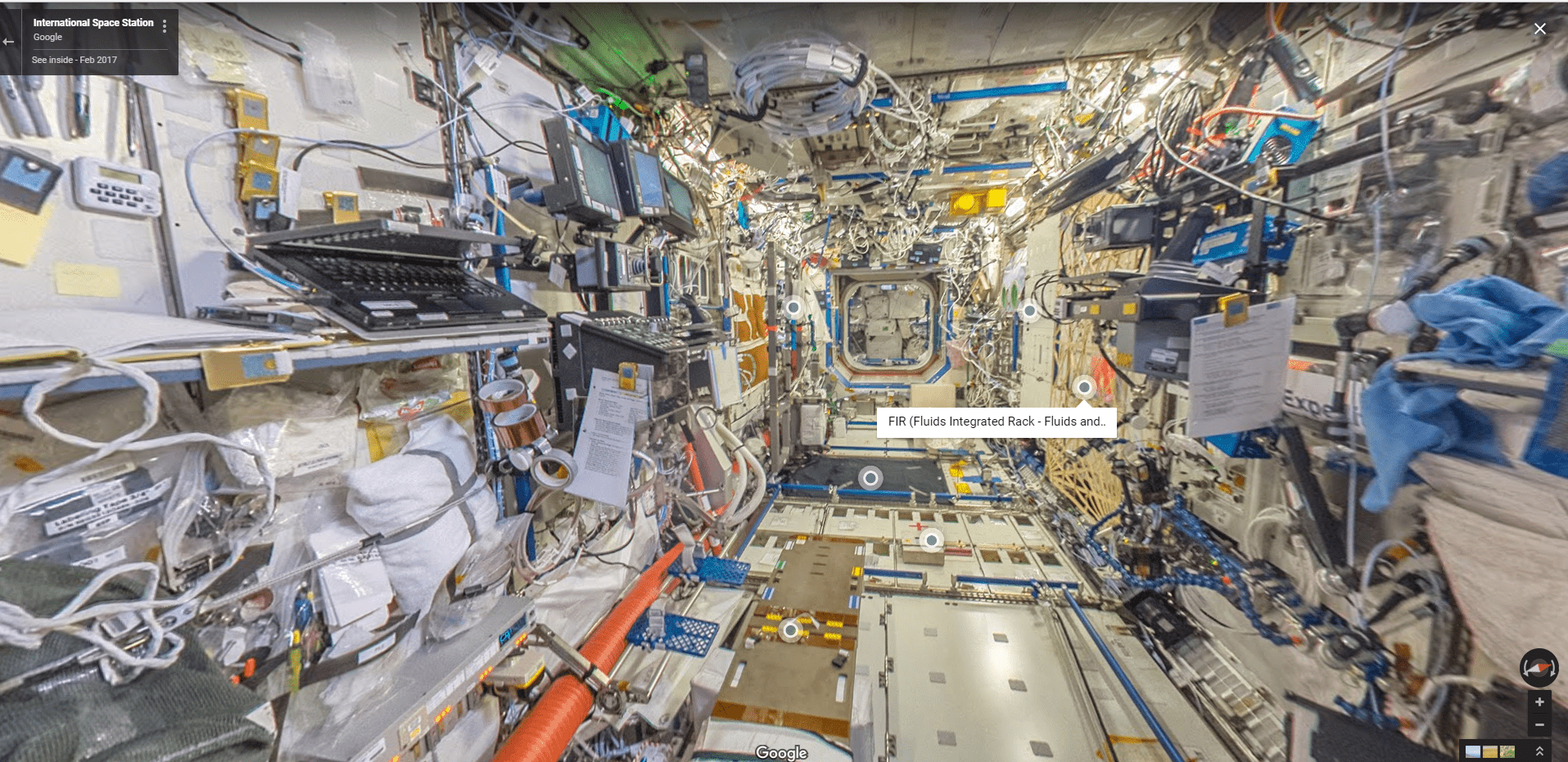
However, this isn’t the only place you can explore with Google Maps outside of Earth. You can also check out maps of Mars, the Moon, and Mercury, though there’s no Street View.
At least not yet.


