A group of United States scientists have dispatched a camera-equipped ocean drone inside a hurricane currently barreling through the Atlantic Ocean. The drone, which looks like a robotic surfboard, will help scientists to improve forecasts models that predict hurricanes, which are expected to get more severe due to the climate crisis.
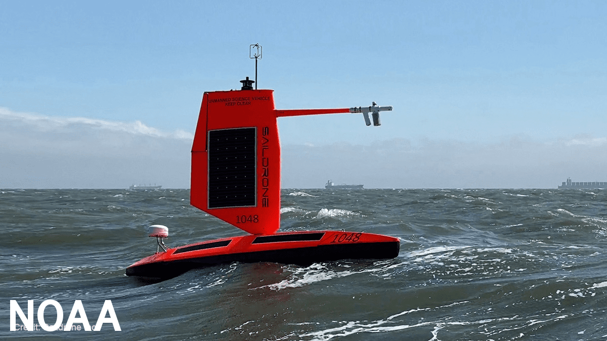
The drone, technically called a “Saildrone” and manufactured by a company with the same name, is being used by the National Oceanic and Atmospheric Administration (NOAA) inside Hurricane Sam. Footage recently released shows the small craft in the middle of the hurricane, amid striking 15-meter waves and winds over 190 kilometers per hour.
While it’s the strongest storm of this year’s Atlantic hurricane season, Hurricane Sam is not expected to make landfall in the US. Still, it’s will generate ocean swells likely to impact the northern Leeward Islands and the Greater Antilles, including Puerto Rico. Bahamas and Bermuda could also experience the ocean swells in the next few days.
“Saildrone is going where no research vessel has ever ventured, sailing right into the eye of the hurricane, gathering data that will transform our understanding of these powerful storms,” Richard Jenkins, Saildrone founder, said in a statement. “After conquering the Arctic and Southern Ocean, hurricanes were the last frontier for Saildrone survivability.”
Understanding hurricanes
The Saildrone is actually just one member of a fleet of five that have been sailing across the Atlantic Ocean during the hurricane season, collecting data to better understand the physical processes of hurricanes. The information is directly being sent to NOAA and to the Atlantic Oceanographic and Meteorological Laboratory, where it’s then reviewed.
They are equipped with a specially designed “hurricane wing” that allows them to operate in extreme wind conditions, as now with Hurricane Sam. The mission can last up to 12 months without the need to return to land for maintenance or refueling, traveling at an average speed between two to six knots, and under satellite supervision.
Each Saildrone has an automatic identification system, navigation lights, radar reflector, and four onboard cameras. They can record all sorts of measurements, such as salinity, temperature, humidity, wind speed and direction, and barometric pressure, knowledge then used by scientists to improve storm forecasting in the near future.
“Using data collected by saildrones, we expect to improve forecast models that predict rapid intensification of hurricanes,” Greg Foltz, a NOAA scientist, said in a statement. “Rapid intensification, when hurricane winds strengthen in a matter of hours, is a serious threat to coastal communities.”
Several hurricanes have reached the United States so far this year in what has been a very active 2021 season, causing major damage, flooding and power outages. One of the most recent ones was Hurricane Ida, which reached Louisiana on the anniversary of Hurricane Katrina – the costliest storm in the history of the US ($125 billion).
Amid the climate crisis, researchers are confident that warmer ocean temperatures and higher sea levels will intensify the intensity and impacts of hurricanes. Studies by NOAA have shown that an increase in Category 4 and Category 5 hurricanes is likely. Hurricane wind speed could increase 10%, with warmers sea temperatures also making them wetter.


