Quantcast
ZME Science
  • News
  • Environment
  • Health
  • Future
  • Space
  • Features
  • ZME & more
    • About
    • The Team
    • Advertise
    • Contribute
    • Our stance on climate change
    • Privacy Policy
    • Contact
No Result
View All Result
ZME Science

No Result
View All Result
ZME Science
Home Science Geology

After the Earthquake: Stunning Photos Show Huge Rock Walls Rising from Below

A sight to behold.

by Mihai Andrei
November 30, 2016
in Geology, Great Pics, News
Share on FacebookShare on TwitterSubmit to Reddit

Geologists from the University of Canterbury witnessed some incredible new land formations created by the magnitude 7.8 quake this month, which pushed the sea floor 2 meters above ground. 

All these are new features created by the earthquake. Image credits: Kate Pedley / University of Canterbury.

Dr Kate Pedley went to inspect the land change caused by the 14 November 7.8 earthquake in the South Island of New Zealand. A large number of ruptures and alternations have been reported in the area, and boy they’re spectacular.

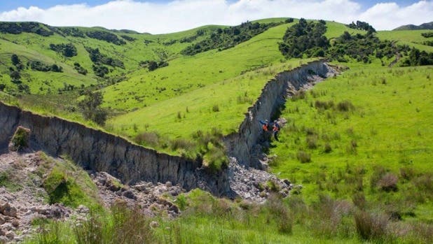
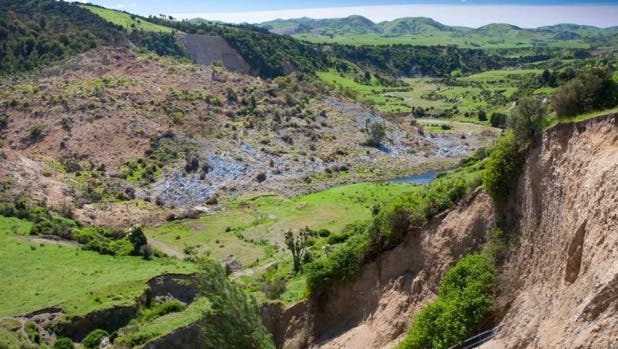
“One side of the fault has moved as much as 11 metres with respect to the other side,” she said in a post on the Geonet website. “Thankfully, those south and west of Waiau generally got off lightly, but it very quickly got messy for infrastructure to the northeast. The amount of associated rockfall, landslides and slumps were incredible.”

Image credits: Kate Pedley, University of Canterbury.

Image credits: Kate Pedley, University of Canterbury.

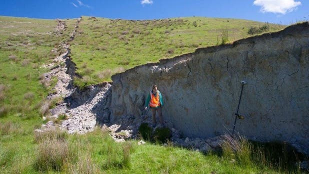
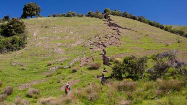
The bulk of the changes were reported on the Kekerengu Fault, near Waiau, a small town north of Canterbury. Geological faults are some of the most common features in the Earth’s crust. The textbook definition goes like this: a fault is a planar fracture or discontinuity in a volume of rock, across which there has been significant displacement as a result of rock mass movement.

She said the Kekerengu fault had been still and lifeless, but all that’s changed. Researchers from around the world had also landed to explore the fault for themselves and were watching on from overseas, a GNS statement said. This is interesting and useful not just to see the effects of the earthquake itself, but to assess future hazard in the area, as well as in other similar areas in the world.

ALSO READ:  Common fabrics can make effective masks against the viral particles, but they're harder to breathe through

A dam was formed by the rising rocks. Image credits: Kate Pedley / University of Canterbury.

ShareTweetShare
ADVERTISEMENT
ADVERTISEMENT
  • News
  • Environment
  • Health
  • Future
  • Space
  • Features
  • ZME & more

© 2007-2021 ZME Science - Not exactly rocket science. All Rights Reserved.

No Result
View All Result
  • News
  • Environment
  • Health
  • Future
  • Space
  • Features
  • ZME & more
    • About
    • The Team
    • Advertise
    • Contribute
    • Our stance on climate change
    • Privacy Policy
    • Contact

© 2007-2021 ZME Science - Not exactly rocket science. All Rights Reserved.

Don’t you want to get smarter every day?

YES, sign me up!

Over 35,000 subscribers can’t be wrong. Don’t worry, we never spam. By signing up you agree to our privacy policy.