The Northrop Grumman B-2 Spirit stealth bomber was designed during the Cold War, featuring technology designed for penetrating dense anti-aircraft defenses. But this bomber may not be so stealthy after all, as one plane was caught flying over farm fields in the Midwest by Google Satellite cameras.
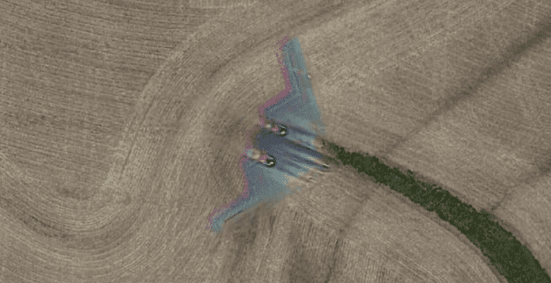
Photo Bomber
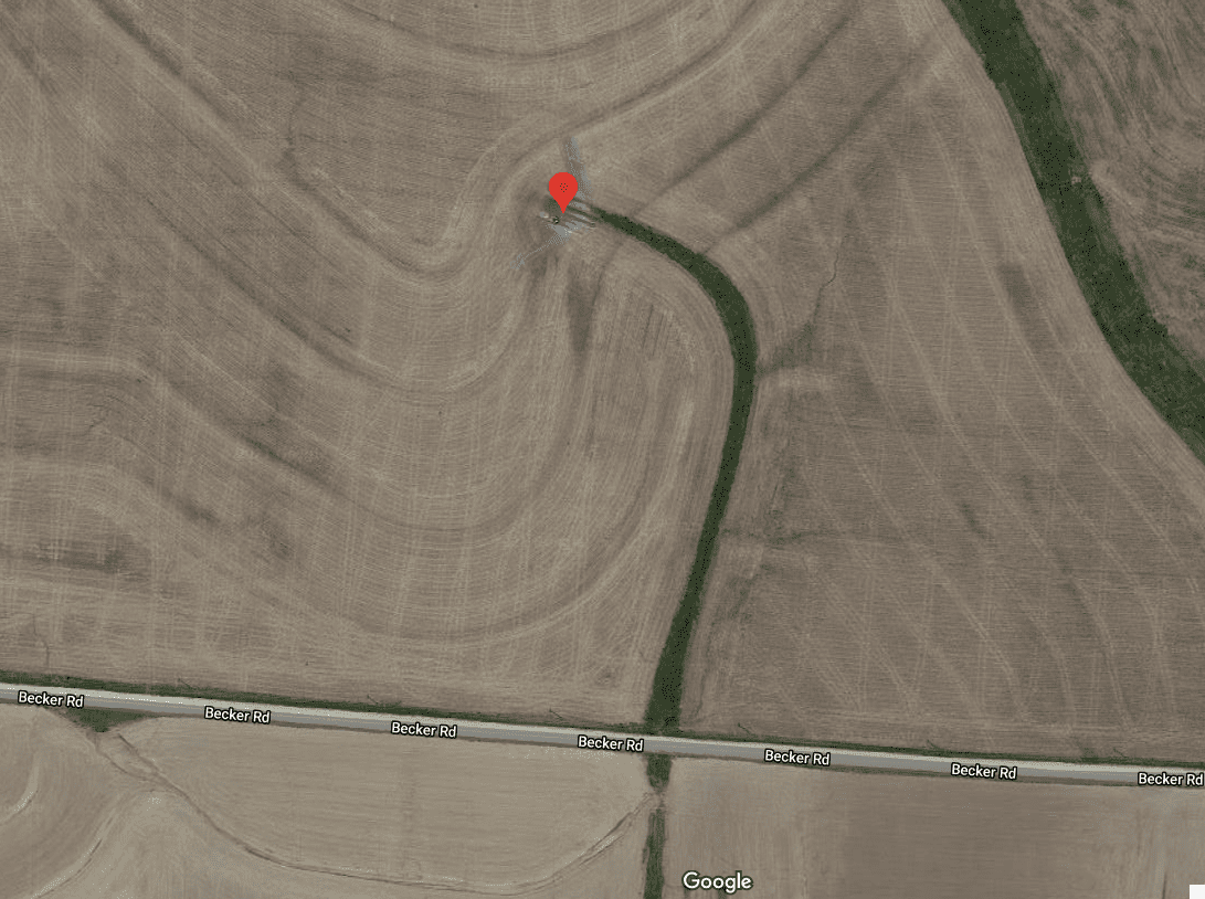
The bomber was first discovered by Redditor Hippowned in the state of Missouri, US, between Kansas City and Saint Louise (some 50 km east of Kansas City). The exact coordinates are 39°01’18.5”,-93°35’40.5” — you can check the spot yourself with this Google Maps link.
The blurry red-green-blue (RGB) halo of the plane is a result of how the image is captured: the satellite cameras first capture the RGB channels separately and then combine them into a single image. As the plane was moving quickly, the integration of the channels is imperfect.
Just 21 of these bombers were ever built. At an average cost of $2 billion, and with a maintenance cost of $6.8 million annually, it’s not hard to understand why there’s so few of them — which makes it all the more impressive that one of them was caught on Google’s cameras.
If you’re interested in spotting your own Northrop Grumman B-2 Spirit bomber, your best chance is in Missouri, at the Whiteman Air Force Base (the current home of the B-2 Spirit).

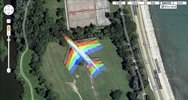
It’s not the first time an airplane was caught on Google’s Maps imagery. In 2010, an airliner was spotted sporting the same RGB halo effect.
Google Maps uses satellites and aerial photography to produce an image of the world. Most satellite images are no more than three years old and updated on a regular basis. The Street View feature boasts over 170 billion images from over 10 million miles around the planet.


