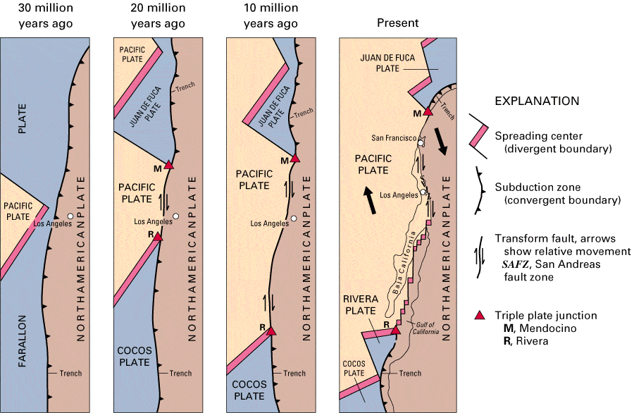
For decades, the accepted theory was that the mountain chains running from Alaska to Mexico were created from fragments of land scraped off a huge tectonic plate moving eastwards, called the Farallon, that converged with North America and sunk below it over the past 200 million years or so. But alas, geologists and geophysicists aren’t always in accord, and a new seismologic study suggests that island arcs, like those in today’s western Pacific, may have piled atop one another, sinking and forming the verical buried slabs we see today. As north American moved to the west and Farallon moved to the east, it scraped off the tops of these slabs, raising mountains in the process.
“This is an important, even momentous, paper,” says Eldridge Moores, a geologist at the University of California in Davis, who proposed a similar westward-diving crustal motion, or subduction, for western North America in 1970 (Moores, E. Nature 228, 837–842 (1970)). “I’m really glad to see it.”
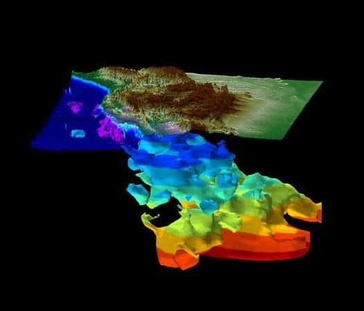
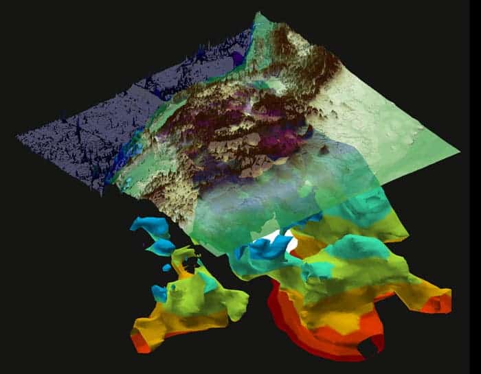
The study was conducted by Karin Sigloch, a seismologist at Ludwig Maximilians University in Munich, Germany, and Mitchell Mihalynuk, a geologist at the British Columbia Geological Survey in Victoria, Canada. Using a method called seismog tomography, they created 3D images of the subducted slabs deep below the continent. Their conclusions, while certainly out of the box, make a lot of sense.
Judging from the images they created, the slabs now look like massive, nearly vertical walls extending from 800 to 2,000 kilometres below the surface of western North America. The first red flag was when they observed that the biggest of these slabs was not connected to the plate now subducting beneath the US Pacific Northwest. Geologists previously believed that the piece was a remnant of the Farallon, but the new data showed the biggest buried slab wasn’t connected to the Farallon at all.
But Sigloch and Mihalynuk took the results from their image and tried to reconstruct where the crustal pieces fit together.
“It was geometrically just not possible,” says Sigloch. “The more we saw, the less sense it made.”
Instead, they came up with a different theory. Island arcs to the west of North America began crashing into the continent, piling atop one another. As North America was pushed to the West, it overrode the islands, some of which piled up and some of which sank beneath the slabs. Finally, oceanic crust began subducting eastward under the continent, in the configuration we see today.
This also solves the longstanding question as to why the buried slabs are piled vertically rather than at an angle.
“A lot of things are just simpler now,” she says.
Via Nature
Was this helpful?


