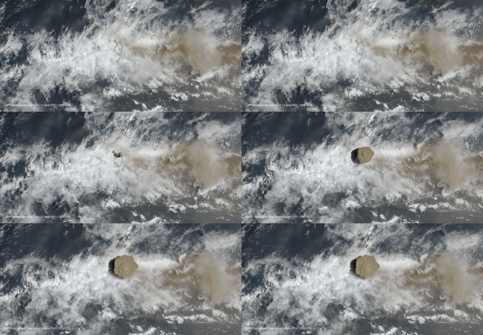
On April 10-11, the La Soufrière volcano in Saint Vincent island had one major eruption, following several minor ones. The plume reached 20 km in the air, leaving the island covered in ashes and with poor visibility. Around 20,000 people needed to evacuate due to the eruptions, triggering a humanitarian crisis in the area.

The impressive eruption moved swiftly across the globe. The plume managed to travel the whole Atlantic, the northern part of Africa, and reached India, more than 14,000 km (9,000 miles) away from the volcano.
An impressive demonstration of that course was presented on the Adam Platform. The team collected images from the European Commission’s Copernicus program, the Sentinel 5P satellite. They used the data to compose an image that shows the SO2 emissions by La Soufrièrev.

The real danger comes with sulfur dioxide (SO2), the volcano’s ashes emitted 400-600 million kilograms of the gas. This is not an imminent issue for the climate, but dangerous enough to cause acid rain and respiratory diseases in the plume’s path.
Acid rain contributes to the acidification of aquatic environments, leaving the places toxic for fish and other species. On land, forests can be damaged by a change in the soil pH and direct impact on the tree’s leaves.
You might be confused about the direction the plume took, especially considering the easterlies: permanent east-to-west winds that flow in the Earth’s equatorial region. However, the plumes reached more than 15 km, the easterlies happen near the surface. What carries the SO2 is the subtropical jet stream, an upper-level current that reaches 400 km/h (250 mph).

You can also monitor the phenomenon with Windy. It is a cool tool to monitor atmospheric phenomena, most of what you see there are forecasts and results from models, real data are included and you can check if what you are seeing is reality or model predictions. For this case, look for the SO2 concentrations.


