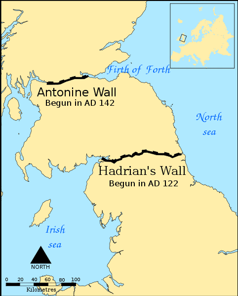
Archaeologists using Lidar have found 134 previously unknown settlements north of Hadrian’s Wall. The wall, which today lies close to the border between England and Scotland, is a fortification constructed by Roman Emperor Hadrian. Stretching from sea to sea, the wall served as a defensive mechanism against “barbarian” populations, and much of the area beyond the wall is relatively unexplored archaeologically.
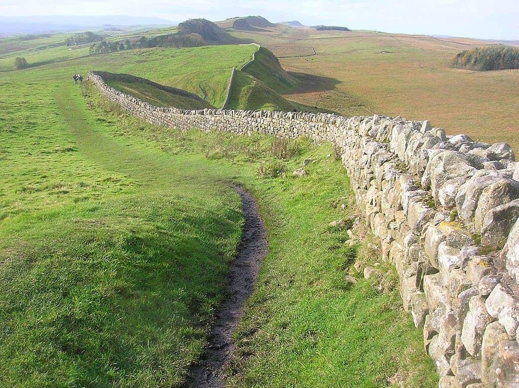
In the year 122, Roman Emperor Hadrian visited Britain. By then, the Romans had conquered most of western Europe, and the Roman Empire was close to its peak. But the Romans were not spared of trouble. Much of today’s Britain was under firm Roman grasp — the territories we now call England and Wales were virtually entirely Roman — but the tribes inhabiting the very north of the island were a different story.
Several Roman emperors tried to conquer parts of what is now Scotland, and while some enjoyed temporary victories, they were pushed out time and time again. They would also raid and attack the Romans occasionally. So Hadrian decided to build a wall like no other: a defensive wall that would mark the northern border of the empire and control who can go in and out of Roman Britain. For nearly three centuries, until the end of Roman rule in Britain in 410 AD, Hadrian’s Wall was a statement of the might of the empire.
The area south of the wall and the Roman structures have been explored archaeologically in great depth, but the area north of the wall is less understood.
“Several issues have traditionally hindered our understanding of this northern frontier,” write the authors of a new study, “including modern administrative borders, academic divides between prehistoric and Roman archaeology, and the limited chronological resolution of much of the material, particularly with regard to indigenous sites. Furthermore, many analyses have adopted a predominantly Roman perspective, focusing primarily on Hadrian’s Wall, the Antonine Wall and the hundreds of Roman forts and temporary camps known in northern Britain. Although this is undoubtedly important, a holistic understanding requires paying greater attention to the indigenous evidence, both through the study of specific sites and wider landscape patterns.”
To address this, researchers from the University of Edinburgh have launched a new project that aims to stud the area beyond the wall and the tribes that never surrendered to Rome (or their predecessors).
The team used airborne Lidar, a laser-based mapping technology that can be used to create an accurate, 3D picture of the landscape. They mapped an area of around 579 square miles (1,500 square km), finding 134 previously unknown Iron Age settlements. Lidar can highlight even small variations in surface topography, so even though the area had been previously surveyed (with other means), it can highlight structures not visible to the naked eye.
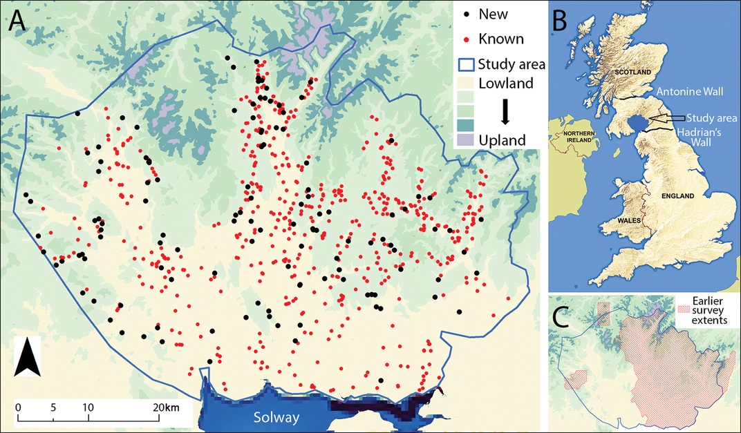
Most of the new finds appear to be farmsteads, and many of them could be Iron Age, from before the Romans built the wall. But the overall painting reveals a dense distribution of sites, which hints at an organized population, well-settled population.
“This is one of the most exciting regions of the Empire, as it represented its northernmost frontier, and because Scotland was one of the very few areas in Western Europe over which the Roman army never managed to establish full control,” said lead author Dr. Fernández Götz, from the University of Edinburgh, in a statement.
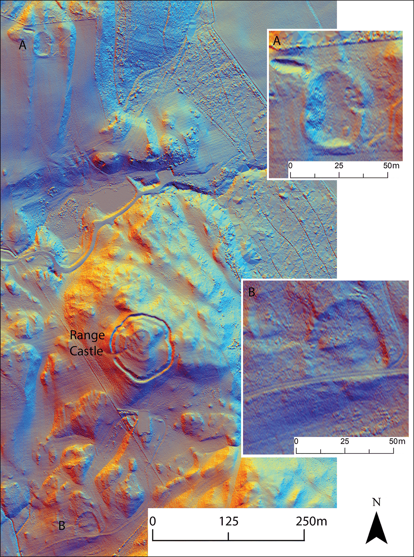
The archaeologists will now zoom in on the features of interest and try to date them and study them in better detail using geophysical methods that can reveal structures below the surface. The researchers want to get a better picture of what life was like on the other side of the wall, and how it may have changed during and after the Roman occupation.
Researchers believe there wasn’t always a conflict between the native populations and Roman troops. There may have been periods of peace and even collaboration, with trade and immigration happening around the wall.
The study was published in the journal of Antiquity.


