Volcanoes are some of the hottest (and coolest) things on the face of the Earth, but not all volcanoes are alike – and not all are like what you see in the movies.
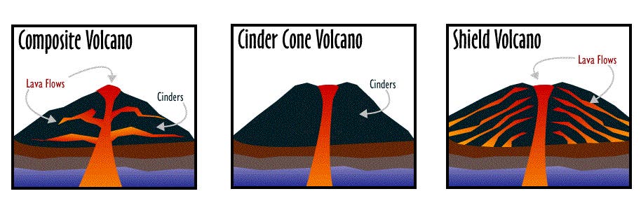
The three main types of volcanoes are:
- stratovolcano (or composite volcano) — a conical volcano consisting of layers of solid lava flows mixed with layers of other rock.
- cinder cone volcano — doesn’t have any horizontal layers, and is instead a steep conical hill of tephra (volcanic debris) that accumulates around and downwind from the vent.
- shield volcano — a type of volcano built entirely or mostly from fluid lava vents. They are named like this because when viewed from above, you can see just how massive and imposing they are – like a warrior’s shield.
Now, let’s jump in more detail.
If you really want to get your hands dirty and dive into volcanoes (figuratively), the fun starts here.
What is a volcano anyway?
Volcanoes are some of the most interesting features on Earth; they are basically ruptures in the Earth’s crust which allow magma to flow upwards. If you want to understand volcanoes, you have to understand plate tectonics. The surface of our planet is not one big piece – it is broken into 17 major, rigid tectonic plates, that move one in relationship to the other. These tectonic plates “float” on a hotter, softer layer in the Earth’s mantle. When that very hot and viscous layer comes up towards the surface, it’s called “magma”. Volcanoes on Earth are generally located in areas where the tectonic plates diverge or converge with each other. It’s easy to understand if you look at a world map with the plate tectonics and volcanoes:
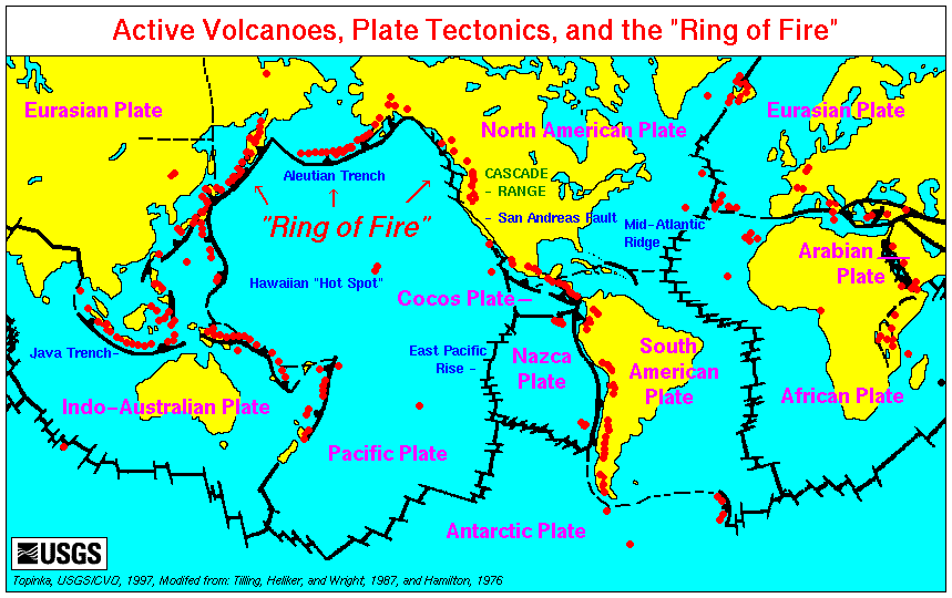
Basically, volcanoes only form where there’s a way for the magma to migrate towards the surface – such as a plate discontinuity or an area where the crust is very thin. There are also so-called “hotspots” – areas where the underlying mantle is much hotter than in other areas, either due to mantle plumes or lithospheric extension (it’s not clear yet which of the two theories is correct). Examples of hotspots include Hawaii and the Portuguese island of Madeira, but for the most part, volcanoes lie at the edge of tectonic plates.

OK, so now we know that volcanoes form where the magma can rise up to the surface, which leads us to the next question:
Why does magma rise to the surface?
The key word here is buoyancy. Magma is very hot, and therefore less dense than the surrounding rocks; it simply rises due to a difference in buoyancy. This lighter magma rises toward the surface, and when its density is lower than the surrounding rocks, it flows towards the surface. But when the magma reaches the surfaces, another interesting thing happens.
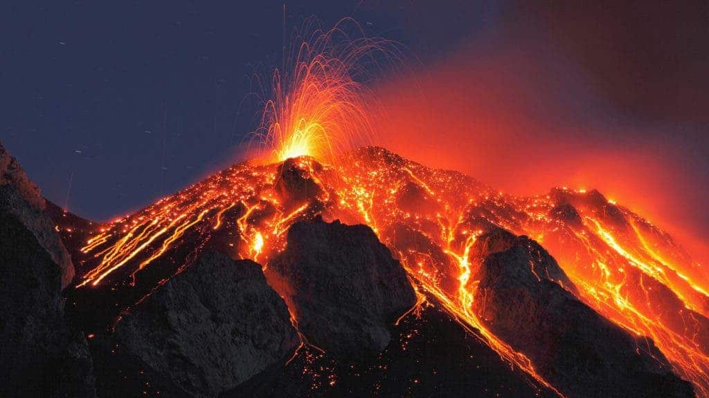
If the magma contains volatile elements (water and/or gases), when it reaches the surface, these volatile elements will suddenly expand into steam and gas, causing a violent eruption. This tends to happen a lot of the magma is more acidic (has a higher silica content); with more basic types of magma, there is usually a continuous, steady flow (like in Hawaii).
So, now that we know what a volcano is and why it forms, let’s take a moment to “dissect one”.
Stratovolcano
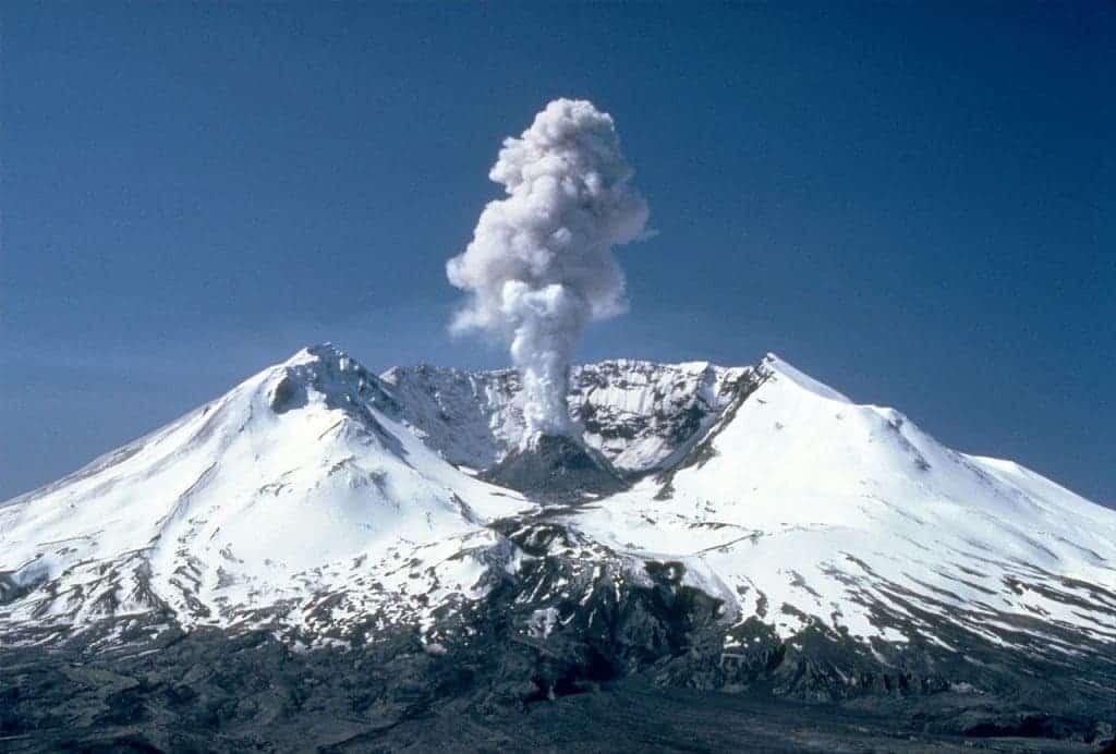
When most people think about a volcano, they just imagine a conical mountain with ash and/or lava spewing out from its mouth. But that’s just one type of volcano – the stratovolcano (or composite volcano).
Stratovolcanoes consist of many layers (strata) of hardened lava, tephra, pumice, and volcanic ash. They generally have steep slopes and are the most common type of volcanoes on Earth. However, we haven’t been able to find composite volcanoes anywhere else in the solar system, with the exception of Mars. These are the “Hollywood volcanoes”, the ones you see in all the movies.
Lyn Topinka – CVO Photo Archive
They tend to form at subduction zones (where one tectonic plate is sliding beneath the other – the oceanic plate beneath the continental plate). Their eruptions are typically explosive and effusive; the magma is generally rich in volatiles because the magma rises as water trapped both in hydrated minerals and porous basalt rock of the upper oceanic crust is released into mantle rock of the asthenosphere above the sinking oceanic slab. This release of water pushes the magma toward the surface. The chemical composition of the magma is intermediate because it incorporates both basic (from the oceanic plate) and acidic minerals (from the continental plate).
The most well-known stratovolcanoes are Krakatoa, Mount Helen, and Vesuvius. Another famous stratovolcano is Mount Tambora – the site of the most powerful eruption in recorded history. Its volcanic cloud lowered global temperatures by as much as 3.5°C for up to one year. In parts of Europe and North America, 1816 was known as the “Year Without a Summer“, which caused a brief but bitter famine.

Cinder Cone Volcano

A cinder cone volcano is simply a steep conical hill of tephra (volcanic debris) that accumulates around and downwind from a volcanic vent. The cinder cones are made from pyroclastic material, which is pretty loose. Cinder cones are commonly found on the flanks of shield volcanoes and stratovolcanoes.
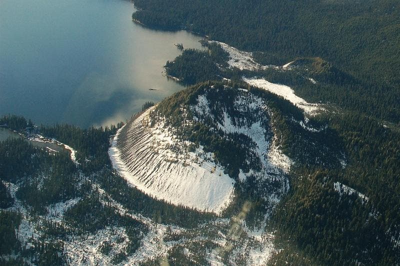
Some cinder cones are different than others, in that they only erupt once. However, even the ones that do erupt typically have a lower impact than stratovolcanoes.
Shield Volcanoes
A shield volcano is a type of volcano usually built almost entirely of fluid lava flows. They have very gentle slopes and are very developed horizontally. These are the classical Hawaii examples – steady flow and accumulation of lava leading to the shield-type formation. Mauna Loa, a shield volcano on the island of Hawaii, is the largest single mountain in the world, rising over 30,000 feet above the ocean floor and reaching almost 100 miles across at its base.
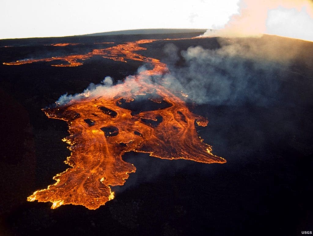
Shield volcanoes are built by effusive eruptions, which flow out in all directions. They almost never have violent eruptions, with basic lava simply flowing out. Although the term is generally ascribed to basaltic shields it has at times been appended to rarer scutiform volcanoes of differing magmatic composition.
Most of what we know today about shield volcanoes comes from the study of the volcanoes in Hawaii. Hawaii lava generally has very high temperatures and low volatiles, and have many lava tubes. In Madeira (Portugal), the volcano is no longer active at the surface, and you can actually walk through the former lava tunnels.

These are the main types of volcanoes. I hope that clears it up a bit, but of course, it’s just the very basic information (pun intended, sorry). If you want more, or still have questions, feel free to message me and send your feedback!


