Quantcast
ZME Science
  • News
  • Environment
  • Health
  • Future
  • Space
  • Features
  • ZME & more
    • About
    • The Team
    • Advertise
    • Contribute
    • Our stance on climate change
    • Privacy Policy
    • Contact
No Result
View All Result
ZME Science

No Result
View All Result
ZME Science
Home Other GeoPicture

GeoPicture of the Week: Folded and Tilded Limestone in Jasper National Park, Alberta, Canada

by Mihai Andrei
January 30, 2015
in GeoPicture
A A
Share on FacebookShare on TwitterSubmit to Reddit

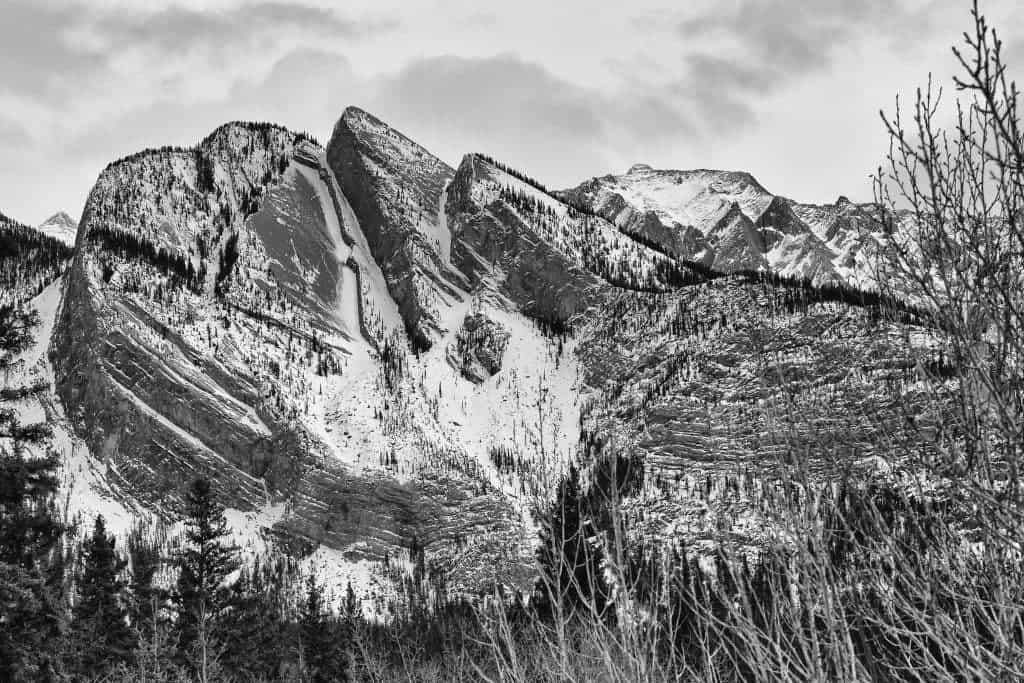
Jasper National Park is truly amazing – beautiful rivers and valleys, several peaks over 3,000 meters, and an overall stunning geology. The western ridge forms the continental divide, separating streams that flow east and north to the Arctic Ocean or Hudson Bay from those which drain westward to the Pacific Ocean. Here, we see a tilted mountain composed of folded limestones. I’m sorry I can’t tell you more about what’s happening here tectonically, and even the author of the picture, reddit user PetroGeol. Here’s what he said:

My best gue… er… interpretation would be a whole lot of folding and thrusting of mississippian and devonian carbonates, most likely the Banff and Palliser formations, likely argillaceous limestones and dolostones.

ShareTweetShare
ADVERTISEMENT
ADVERTISEMENT
  • News
  • Environment
  • Health
  • Future
  • Space
  • Features
  • ZME & more

© 2007-2021 ZME Science - Not exactly rocket science. All Rights Reserved.

No Result
View All Result
  • News
  • Environment
  • Health
  • Future
  • Space
  • Features
  • ZME & more
    • About
    • The Team
    • Advertise
    • Contribute
    • Our stance on climate change
    • Privacy Policy
    • Contact

© 2007-2021 ZME Science - Not exactly rocket science. All Rights Reserved.