ZME Science
No Result
View All Result
ZME Science
No Result
View All Result
ZME Science

Home → Science → News

Let it Go! – NASA Almost Ready to Start Mapping Frozen Soil

With spring starting to settle in, snow is likely the last thing on people's minds - but NASA is taking snow really seriously. They want to put satellites in orbit to understand how the frozen lands in the polar areas are developing and adapting to climate change.

Dragos MitricabyDragos Mitrica
March 20, 2015
in Environment, News, Space
A A
Share on FacebookShare on TwitterSubmit to Reddit

With spring starting to settle in, snow is likely the last thing on people’s minds – but NASA is taking snow really seriously. They want to put satellites in orbit to understand how the frozen lands in the polar areas are developing and adapting to climate change.

Image via ESA.

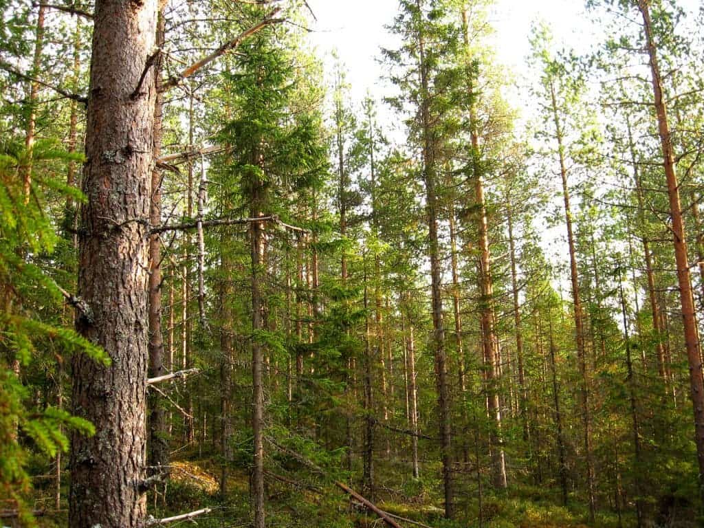
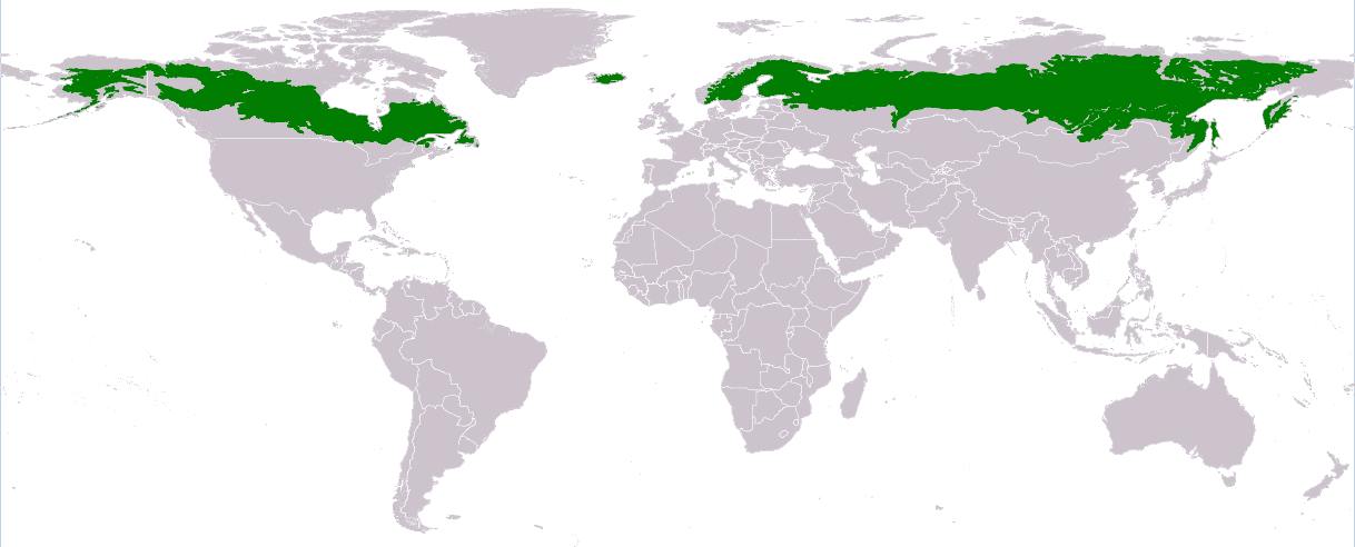
The ecosystem that interests scientists mosts are the boreal forests. The taigas (or boreal forests) are generally coniferous forests consisting mostly of pines, spruces and larches. The taigas are the world’s largest terrestrial biome, covering 15% of the Earth’s land surface. In North America they cover most of inland Canada and Alaska as well as parts, in Eurasia, they cover covers most of Sweden, Finland, much of Norway and Russia, some lowland/coastal areas of Iceland, and areas of northern Kazakhstan, northern Mongolia, and northern Japan (on the island of Hokkaidō). But even so, because they are so large and inhospitable, we know very little of the way they are changing.

“What we have now are very sparse, seasonal measurements from the ground,” said John Kimball, a professor of systems ecology at the University of Montana, Missoula, and a member of the science team for NASA’s Soil Moisture Active Passive (SMAP) mission, launched Jan. 31. “We do have long-term, global satellite data sets that are sensitive to freeze-thaw, but they tend to be very coarse.” That means each measurement averages the status of a large area. Like a mosaic made of large tiles, these data cannot show much detail.

Taiga covers 15 percent of the Earth’s dry land. Image via Wikipedia.

Despite the wishes of Republican senator Ted Cruz, NASA will put an end to that – by the end of April, SMAP will monitor the frozen or thawed state of the landscape north of 45 degrees north latitude (about the latitude of Minneapolis) every two days. Its main purpose is to measure the amount of moisture in the top few inches of soil globally, but it also detects whether that moisture is frozen or in liquid form. SMAP’s radar measurements, with “tiles” only half a mile to a mile and a half (1 to 3 kilometers) across, will reveal far more detail than scientists now have about the freeze/thaw status of the land surface.

The greater detail is very important because especially in the Arctic areas, you can have very high variations over very small surfaces, depending on solar light and potential shade. The early weeks of spring are especially crucial for this kind of study, because that’s when most of the magic happens.

“Once the vegetation thaws, boom! Photosynthesis takes off,” Kimball explained. “You can get your highest rates of photosynthesis within a few weeks after the thaw, and a later thaw can mean much lower vegetation growth for the season. We need observations at what I call the landscape level to more precisely monitor those patterns and changes.”

With the scarcity of available Arctic data, there is no satisfactory general model that predicts what the future might hold. Hopefully, SMAP will help fix that.

RelatedPosts

Japan start-up planning to sell “shooting stars on demand” launched their first satellite
Tiny satellites reveal how urban trees respond to rising heat
New Zealand startup launches huge ‘disco ball’ into space. It’s now the brightest object in the night sky
The Blue Marble: the most stunning, high-res photo of the Earth

Source: NASA.

Tags: boreal forestsatellitetaiga

ShareTweetShare
Dragos Mitrica

Dragos Mitrica

Dragos has been working in geology for six years, and loving every minute of it. Now, his more recent focus is on paleoclimate and climatic evolution, though in his spare time, he also dedicates a lot of time to chaos theory and complex systems.

Related Posts

Mapping vertical land motion across the New York City area, researchers found the land sinking (indicated in blue) by about 0.06 inches (1.6 millimeters) per year on average. They also detected modest uplift (shown in red) in Queens and Brooklyn. White dotted lines indicate county/borough borders. Credit: NASA/JPL-Caltech/Rutgers University.
Geology

Satellite data shows New York City is still sinking — and so are many big US cities

byFermin Koop
9 hours ago
News

Astronomers Warn That Satellite Mega-Constellations Could Steal the Night Sky Forever

byMihai Andrei
3 weeks ago
Climate

White House Wants to Destroy NASA Satellites Tracking Climate Change and Plant Health

byMihai Andrei
1 month ago
Climate

Climate Change Unleashed a Hidden Wave That Triggered a Planetary Tremor

byMihai Andrei
3 months ago

Recent news

A 2,300-Year-Old Helmet from the Punic Wars Pulled From the Sea Tells the Story of the Battle That Made Rome an Empire

September 15, 2025

Scientists Hacked the Glue Gun Design to Print Bone Scaffolds Directly into Broken Legs (And It Works)

September 15, 2025

New Type of EV Battery Could Recharge Cars in 15 Minutes

September 15, 2025
  • About
  • Advertise
  • Editorial Policy
  • Privacy Policy and Terms of Use
  • How we review products
  • Contact

© 2007-2025 ZME Science - Not exactly rocket science. All Rights Reserved.

No Result
View All Result
  • Science News
  • Environment
  • Health
  • Space
  • Future
  • Features
    • Natural Sciences
    • Physics
      • Matter and Energy
      • Quantum Mechanics
      • Thermodynamics
    • Chemistry
      • Periodic Table
      • Applied Chemistry
      • Materials
      • Physical Chemistry
    • Biology
      • Anatomy
      • Biochemistry
      • Ecology
      • Genetics
      • Microbiology
      • Plants and Fungi
    • Geology and Paleontology
      • Planet Earth
      • Earth Dynamics
      • Rocks and Minerals
      • Volcanoes
      • Dinosaurs
      • Fossils
    • Animals
      • Mammals
      • Birds
      • Fish
      • Amphibians
      • Reptiles
      • Invertebrates
      • Pets
      • Conservation
      • Animal facts
    • Climate and Weather
      • Climate change
      • Weather and atmosphere
    • Health
      • Drugs
      • Diseases and Conditions
      • Human Body
      • Mind and Brain
      • Food and Nutrition
      • Wellness
    • History and Humanities
      • Anthropology
      • Archaeology
      • History
      • Economics
      • People
      • Sociology
    • Space & Astronomy
      • The Solar System
      • Sun
      • The Moon
      • Planets
      • Asteroids, meteors & comets
      • Astronomy
      • Astrophysics
      • Cosmology
      • Exoplanets & Alien Life
      • Spaceflight and Exploration
    • Technology
      • Computer Science & IT
      • Engineering
      • Inventions
      • Sustainability
      • Renewable Energy
      • Green Living
    • Culture
    • Resources
  • Videos
  • Reviews
  • About Us
    • About
    • The Team
    • Advertise
    • Contribute
    • Editorial policy
    • Privacy Policy
    • Contact

© 2007-2025 ZME Science - Not exactly rocket science. All Rights Reserved.