Quantcast
ZME Science
  • News
  • Environment
  • Health
  • Future
  • Space
  • Features
  • ZME & more
    • About
    • The Team
    • Advertise
    • Contribute
    • Our stance on climate change
    • Privacy Policy
    • Contact
No Result
View All Result
ZME Science

No Result
View All Result
ZME Science
Home Other Great Pics

Narelle cyclone looking dangerous in Australia

by Mihai Andrei
March 4, 2016
in Great Pics, Offbeat
Share on FacebookShare on TwitterSubmit to Reddit

Image via NASA.

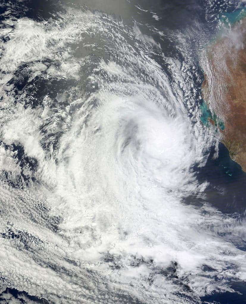
As if the giant fires fueled by record high temperatures weren’t enough, Australia is also being hit by Narelle – a tropical cyclone of significant proportions.

The eye-catching photographs accompanying this story were captured by Brett Martin just before sunset on Wednesday afternoon, about 40-50 km off shore; they depict a “tropical squall line” and a “gust front ahead of a storm line”, the red tinge representing the dust Narella picked up on its road to the sea.

According to mister Martin, before the line of the storm, the weather was crystal clear, but weather arrived, the swell lifted to two metres, winds increased to 40 knots and visibility was reduced to 100 metres.


ShareTweetShare
ADVERTISEMENT
ADVERTISEMENT
  • News
  • Environment
  • Health
  • Future
  • Space
  • Features
  • ZME & more

© 2007-2021 ZME Science - Not exactly rocket science. All Rights Reserved.

No Result
View All Result
  • News
  • Environment
  • Health
  • Future
  • Space
  • Features
  • ZME & more
    • About
    • The Team
    • Advertise
    • Contribute
    • Our stance on climate change
    • Privacy Policy
    • Contact

© 2007-2021 ZME Science - Not exactly rocket science. All Rights Reserved.

Don’t you want to get smarter every day?

YES, sign me up!

Over 35,000 subscribers can’t be wrong. Don’t worry, we never spam. By signing up you agree to our privacy policy.