ZME Science
No Result
View All Result
ZME Science
No Result
View All Result
ZME Science

Home → Space

First amazing photos of Earth and its weather beamed back by NOAA’s most advanced satellite

More than just pretty pictures.

Tibi PuiubyTibi Puiu
January 24, 2017
in News, Space
A A
Share on FacebookShare on TwitterSubmit to Reddit

RelatedPosts

Scientists witness sub-Antarctic volcano erupting
Strange interstellar stone discovered in Egypt is like nothing else found in the solar system
Fool’s gold is ocean’s fertilizer
Some water ice on the Moon is billions of years old — and colonists could drink it all up
This composite color full-disk visible animation is from 1:07 p.m. EDT on January 15, 2017 and was created using several of the 16 spectral channels available on the GOES-16 Advanced Baseline Imager (ABI) instrument. Credit: NASA, NOAA.

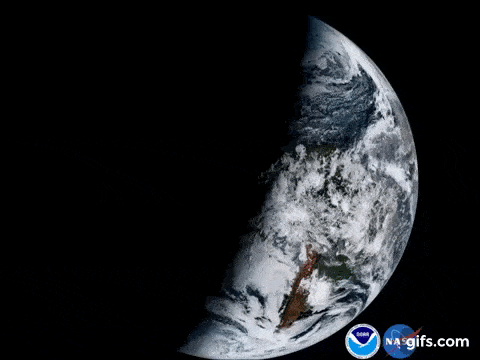
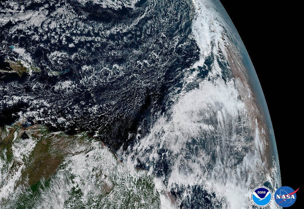
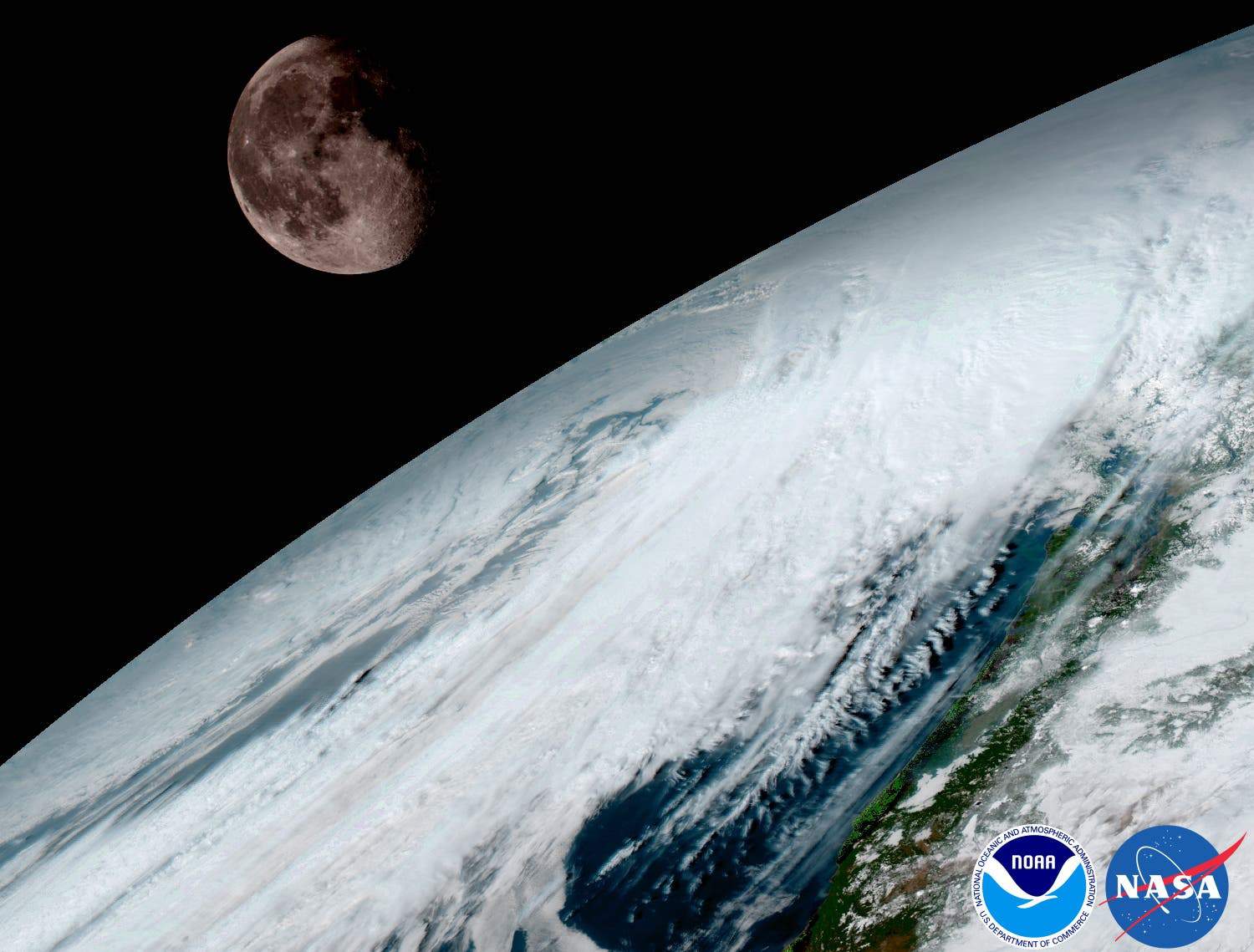
NOAA’s GOES-16 satellite, formerly known as GOES-R, is the most technically advanced weather satellite of its kind. It launched last year in November with the promise of making Earth and space weather observations more refined than ever before. Now, GOES-16 is fully operational and NOAA has been gracious enough to share the satellite’s point of view with an unprecedented series of high-resolution images.

The Saharan Dust Layer can be discerned in the far right edge of this image of Earth. This dry air from the coast of Africa can have impacts on tropical cyclone intensity and formation. GOES-16’s ability to observe this phenomenon with its 16 spectral channels will enable forecasters to study related hurricane intensification as storms approach North America. Credit: NOAA, NASA

“Seeing these first images from GOES-16 is a foundational moment for the team of scientists and engineers who worked to bring the satellite to launch and are now poised to explore new weather forecasting possibilities with this data and imagery,” said Stephen Volz, Ph.D., NOAA’s Assistant Administrator for Satellite and Information Services. “The incredibly sharp images are everything we hoped for based on our tests before launch. We look forward to exploiting these new images, along with our partners in the meteorology community, to make the most of this fantastic new satellite.”

From its central location, GOES-16 captured this image of the west coast of the United States and the Baja Peninsula in Mexico. Once GOES-16 is determined to be operational as either GOES-East or GOES-West, GOES-S, the next spacecraft in the series, which is planned for launch in Spring 2018 will be moved into the other operational position as GOES-17. Credit: NASA/NOAA

NOAA claims GOES-16 will usher in a new age of “high-definition from the heavens.” The information this satellite will beam back, however, won’t be just some pretty pictures, though these aren’t for sure in low supply. According to NOAA, the wealth of new data could help dramatically improve weather forecasts. Particularly, extreme freak weather will be forecasted with greater accuracy, which should ultimately save lives.

GOES-16 captured this view of the moon as it looked across the surface of the Earth on January 15. Like earlier GOES satellites, GOES-16 will use the moon for calibration. Credit: NASA/NOAA.

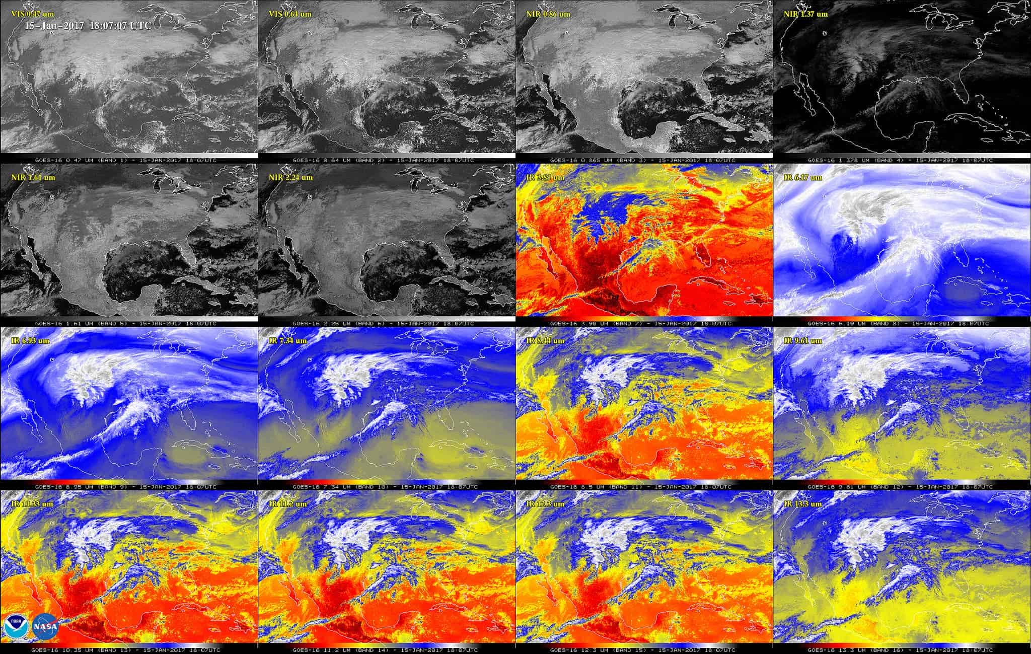
The shot below does a good job at summarizing the GOES-16 imaging capabilities. What are you seeing is essentially the same viewpoint captured using different wavelengths of light. Such observations allow scientists to distinguish between the atmosphere’s various components, like clouds, water vapor, smoke, dust and soon.

This 16-panel image shows the continental United States in the two visible, four near-infrared and 10 infrared channels on ABI. These channels help forecasters distinguish between differences in the atmosphere like clouds, water vapor, smoke, ice and volcanic ash. GOES-16 has three-times more spectral channels than earlier generations of GOES satellites. Credit: NASA/NOAA

“This image is much more than a pretty picture, it is the future of weather observations and forecasting,” said Louis W. Uccellini, Ph.D., director, NOAA’s National Weather Service. “High resolution imagery from GOES-16 will provide sharper and more detailed views of hazardous weather systems and reveal features that previous instruments might have missed, and the rapid-refresh of these images will allow us to monitor and predict the evolution of these systems more accurately. As a result, forecasters can issue more accurate, timely, and reliable watches and warnings, and provide better information to emergency managers and other decision makers.”

NOAA will upgrade the mission with a new GOES satellite slated for a 2018 launch.

ShareTweetShare
Tibi Puiu

Tibi Puiu

Tibi is a science journalist and co-founder of ZME Science. He writes mainly about emerging tech, physics, climate, and space. In his spare time, Tibi likes to make weird music on his computer and groom felines. He has a B.Sc in mechanical engineering and an M.Sc in renewable energy systems.

Related Posts

News

Meet the Dragon Prince: The Closest Known Ancestor to T-Rex

byTibi Puiu
2 hours ago
Biology

Your Breathing Is Unique and Can Be Used to ID You Like a Fingerprint

byTibi Puiu
3 hours ago
Health

In the UK, robotic surgery will become the default for small surgeries

byMihai Andrei
3 hours ago
Health

Bioengineered tooth “grows” in the gum and fuses with existing nerves to mimic the real thing

byMihai Andrei
4 hours ago

Recent news

Meet the Dragon Prince: The Closest Known Ancestor to T-Rex

June 13, 2025

Your Breathing Is Unique and Can Be Used to ID You Like a Fingerprint

June 13, 2025

In the UK, robotic surgery will become the default for small surgeries

June 13, 2025
  • About
  • Advertise
  • Editorial Policy
  • Privacy Policy and Terms of Use
  • How we review products
  • Contact

© 2007-2025 ZME Science - Not exactly rocket science. All Rights Reserved.

No Result
View All Result
  • Science News
  • Environment
  • Health
  • Space
  • Future
  • Features
    • Natural Sciences
    • Physics
      • Matter and Energy
      • Quantum Mechanics
      • Thermodynamics
    • Chemistry
      • Periodic Table
      • Applied Chemistry
      • Materials
      • Physical Chemistry
    • Biology
      • Anatomy
      • Biochemistry
      • Ecology
      • Genetics
      • Microbiology
      • Plants and Fungi
    • Geology and Paleontology
      • Planet Earth
      • Earth Dynamics
      • Rocks and Minerals
      • Volcanoes
      • Dinosaurs
      • Fossils
    • Animals
      • Mammals
      • Birds
      • Fish
      • Amphibians
      • Reptiles
      • Invertebrates
      • Pets
      • Conservation
      • Animal facts
    • Climate and Weather
      • Climate change
      • Weather and atmosphere
    • Health
      • Drugs
      • Diseases and Conditions
      • Human Body
      • Mind and Brain
      • Food and Nutrition
      • Wellness
    • History and Humanities
      • Anthropology
      • Archaeology
      • History
      • Economics
      • People
      • Sociology
    • Space & Astronomy
      • The Solar System
      • Sun
      • The Moon
      • Planets
      • Asteroids, meteors & comets
      • Astronomy
      • Astrophysics
      • Cosmology
      • Exoplanets & Alien Life
      • Spaceflight and Exploration
    • Technology
      • Computer Science & IT
      • Engineering
      • Inventions
      • Sustainability
      • Renewable Energy
      • Green Living
    • Culture
    • Resources
  • Videos
  • Reviews
  • About Us
    • About
    • The Team
    • Advertise
    • Contribute
    • Editorial policy
    • Privacy Policy
    • Contact

© 2007-2025 ZME Science - Not exactly rocket science. All Rights Reserved.