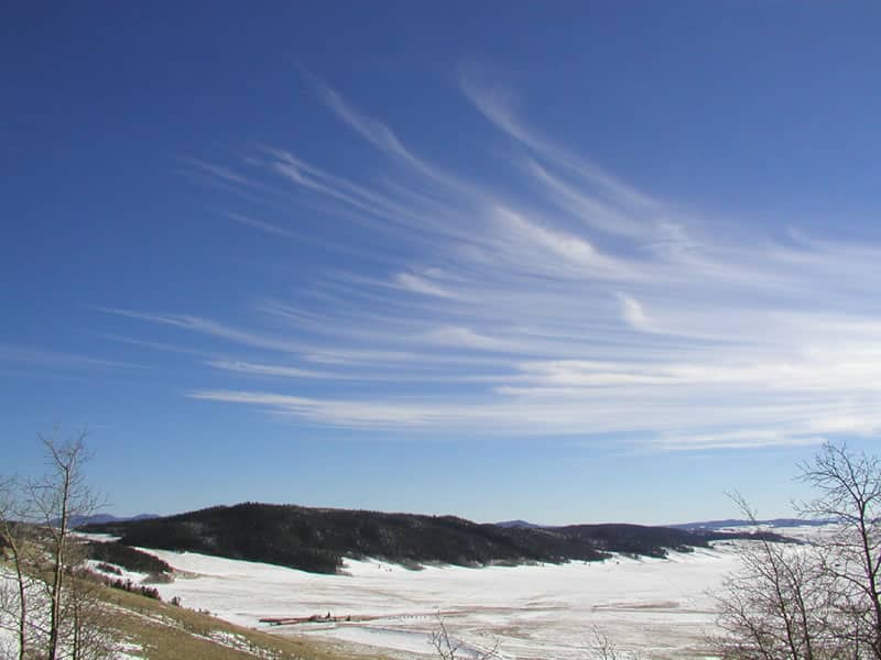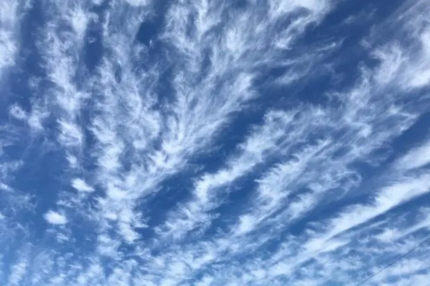
Cirrus clouds, the high-altitude residents of the atmosphere, have intriguing characteristics and play a significant role in the Earth’s climate system. As you delve into the world of these feathery clouds, you’ll uncover the science behind their formation, their impact on weather patterns, and how to identify them in the vast sky.
What Are Cirrus Clouds?
Cirrus clouds are thin, delicate types of clouds found at high altitudes, typically above 20,000 feet (6,000 meters). They are composed of tiny ice crystals and form in the upper troposphere, where temperatures are extremely cold. Due to their lofty position, they often appear wispy and can stretch across the sky for miles, creating mesmerizing patterns that spark curiosity in sky gazers like you.
Identifying Cirrus Clouds

Spotting cirrus clouds is a treat due to their unique appearance. To identify them, look for the following characteristics:
- Feathery Appearance: Cirrus clouds have a wispy, fibrous structure, resembling the tail of a horse or the streaks of a painter’s brush. Their fine texture sets them apart from other cloud types.
- High Altitude: These clouds are the highest of the cloud family and are usually located above other cloud types. Their position near the top of the troposphere allows them to catch the sun’s rays even after sunset, giving them a beautiful golden hue.
- Transparent: Cirrus clouds are thin and translucent, allowing sunlight to pass through them. This transparency contributes to their graceful and almost ethereal appearance.
- “Mare’s Tails” and “Mackerel Sky”: Cirrus clouds sometimes form recognizable patterns like “mare’s tails,” which are long, thin streaks, or a “mackerel sky,” resembling fish scales. Observing these patterns can be a rewarding experience for skywatchers.
How Cirrus Clouds Form
Cirrus clouds owe their existence to the presence of ice crystals at high altitudes. The process begins with tiny particles, known as ice nuclei, which serve as seeds for ice crystal formation. Water vapor in the atmosphere condenses onto these nuclei, forming tiny ice crystals.
As these ice crystals grow and accumulate, they become the building blocks of cirrus clouds. Wind patterns at high altitudes play a crucial role in shaping the characteristic feathery appearance of cirrus clouds, adding to their distinct charm.
Cirrus Clouds and Weather Prediction

While cirrus clouds themselves are not known to produce precipitation, they play a vital role in weather prediction. Their presence and characteristics provide valuable information to meteorologists. For instance:
- Indicators of Weather Changes: An increase in cirrus clouds can precede a weather system’s arrival, such as an approaching warm or cold front. Monitoring changes in cirrus cloud patterns helps predict shifts in weather conditions.
- Jet Stream Markers: The formation of cirrus clouds can also indicate the presence and location of the jet stream, a high-altitude, fast-flowing air current that significantly influences weather patterns.
Remember, cirrus clouds are not just pretty sights in the sky; they are valuable indicators of atmospheric conditions and weather patterns. Next time you look up and spot these wispy wonders, you can marvel at the fascinating science that lies behind their appearance and be better equipped to appreciate the dynamic nature of our planet’s atmosphere.
Cirrus Clouds FAQ
Yes, cirrus clouds play a crucial role in weather prediction. Their presence and characteristics provide valuable information to meteorologists, helping them predict weather changes and locate the jet stream.
Yes, an increase in cirrus clouds can precede the arrival of a weather system, such as a warm or cold front, making them useful indicators of changing weather conditions.
Cirrus clouds are generally not hazardous for aviation, as they are thin and transparent. However, pilots should always be aware of weather conditions and any potential changes.
The fibrous, feathery appearance of cirrus clouds is a result of wind patterns at high altitudes, shaping the ice crystals into delicate streaks and wisps.
Yes, cirrus clouds can be visible even after sunset, as their high altitude allows them to catch sunlight from below the horizon.
Cirrus clouds can have both warming and cooling effects on the Earth’s climate. They trap some of the outgoing heat from the surface, contributing to warming. However, they also reflect incoming sunlight, which can lead to cooling.
While cirrus clouds play a role in the Earth’s climate system, they are not directly caused by climate change. However, changes in their frequency and distribution can be influenced by climate variations.
Cirrus clouds can sometimes affect stargazing or astronomy, as they may obscure stars and celestial objects. However, their thin nature means they often have minimal impact on observing the night sky.
Cirrus clouds come in various forms, including cirrus fibratus (wispy), cirrus uncinus (hook-shaped), and cirrus spissatus (dense). Each type has its own distinct characteristics.
The lifespan of cirrus clouds can vary. Some may persist for hours, while others may dissipate relatively quickly due to changing atmospheric conditions.
Yes, cirrus clouds are widespread and can be found in various regions across the globe. They are a common sight in both tropical and polar regions.
Cirrus clouds generally do not have a direct impact on agriculture, as they do not produce precipitation. However, their presence can be indicative of changes in weather patterns that may influence farming decisions.
Was this helpful?


