Quantcast
ZME Science
  • News
  • Environment
  • Health
  • Future
  • Space
  • Features
  • ZME & more
    • About
    • The Team
    • Advertise
    • Contribute
    • Our stance on climate change
    • Privacy Policy
    • Contact
No Result
View All Result
ZME Science

No Result
View All Result
ZME Science
Home Other GeoPicture

GeoPicture of the week: Langisjor, highlands of Iceland

by Mihai Andrei
January 29, 2013
in GeoPicture
A A

My apologies, ladies and gents! I’ve been neglecting this section of our site, as some of you have told me via email (feedback is always welcome, by the way). So after a short pause, we’re bringing it back, stronger than ever: Here’s the GeoPicture of the week:

iceland
Click here for the full pic – I really recommend it!

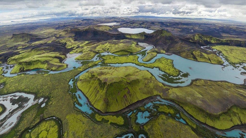
This is a lake called Langisjór, covering an area of about total surface area of about 26 km² and a maximum depth of 75m. The government plans to create an industrial dam on the lake, something which environmentalists strongly campaign against – and for good reason! The beauty of this place, like more others from Iceland is just epic.

*Edit: the Lagnisjor lake is actually behing the photographer here, what you are seeing here are indeed its highlands, but the two lakes in this picture are called Kambavatn (center) and Lambavatn (left).

ADVERTISEMENT
ADVERTISEMENT
  • News
  • Environment
  • Health
  • Future
  • Space
  • Features
  • ZME & more

© 2007-2021 ZME Science - Not exactly rocket science. All Rights Reserved.

No Result
View All Result
  • News
  • Environment
  • Health
  • Future
  • Space
  • Features
  • ZME & more
    • About
    • The Team
    • Advertise
    • Contribute
    • Our stance on climate change
    • Privacy Policy
    • Contact

© 2007-2021 ZME Science - Not exactly rocket science. All Rights Reserved.