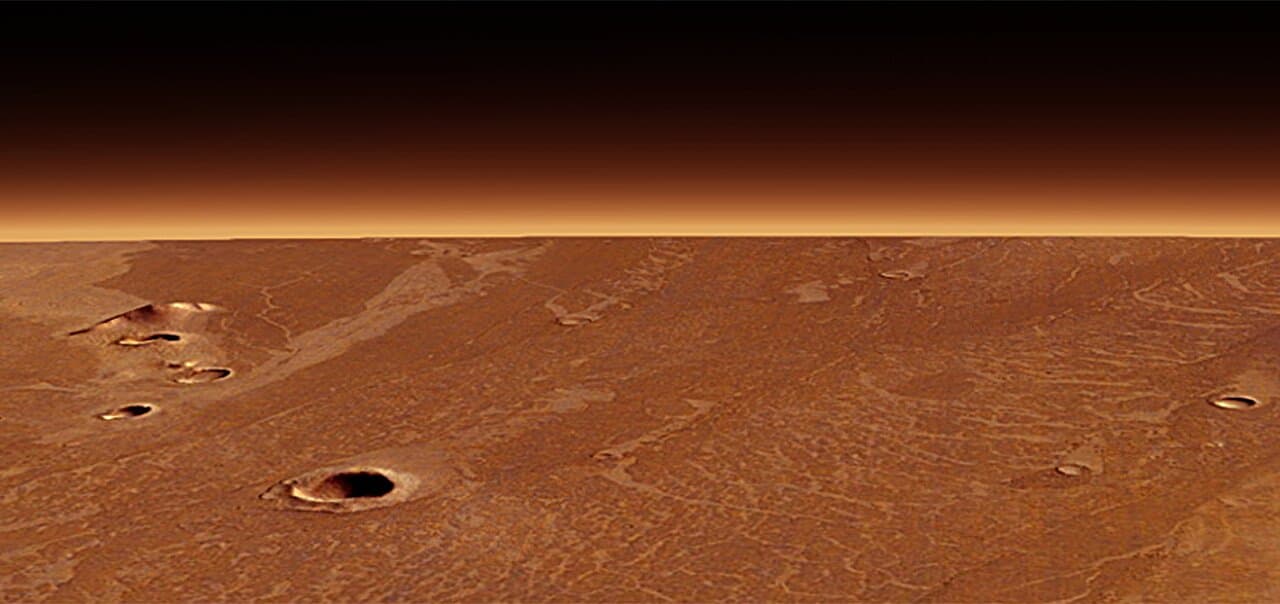
Antarctica in the past: warm and flat, before glaciers shaped it
We have a rather sound image in our heads of Antarctica: cold, barren and damn well inhospitable. Million of years ago before a big freeze turned the continent into a huge popsicle, Antarctica was flat, covered in vegetation and riddled with flowing rivers and life. University of Arizona researchers have sampled key sediments from the Lambert Graben […]
We have a rather sound image in our heads of Antarctica: cold, barren and damn well inhospitable. Million of years ago before a big freeze turned the continent into a huge popsicle, Antarctica was flat, covered in vegetation and riddled with flowing rivers and life. University of Arizona researchers have sampled key sediments from the Lambert Graben valley and have uncovered details to how the continent’s surface was shaped today, while also offering valuable date that might decode how it will look like in the future.
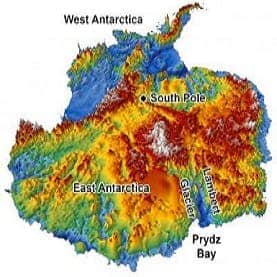
This 3-D reconstruction of the topography hidden under Antarctica’s two-mile-thick coating of ice was made using data from radar surveys. (c) Stuart N. Thomson/UA department of geosciences
The Lambert Graben valley in East Antarctica is today home to the world’s largest glacier, but along time ago a broad flowing river followed its inner contours. This particularity has left geologists for years perplexed in the face of the valley’s present highly steeped features. What carved these features?
Stuart Thomson, a geologist at the University of Arizona (UA) in Tucson, along with colleagues collected sediment samples from the river bed after painstakingly drilling. These were compared with sediment samples collected from the ocean floor just offshore of Lambert Glacier, as well as from onshore moraines – rock piles elevated by glacier formation.
This comparative analysis revealed that theriver sands are topped with a thick layer of coarser sediment that signals the onset of glacial erosion in the valley, the researchers found. This erosion rate more than doubled when the glaciers moved in some 35 million years ago during Antarctica’s deep freeze.
“The only way that could happen is from glaciers,” Thomson said. “They started grinding and forming deep valleys.”
This new found information might prove to be critical for developing more precise climate models relating to the region, particularly those related to glacier flow. Naturally, glaciers flow over surfaces, and knowing how glaciers behaved in the past over these surfaces will help model how they will flow in the future as well.
The sediment samples also hold clues to the continent’s tectonic evolution. Up until some 80 million years ago Antarctica was connected with Africa and India in a supercontinent called Gondwana. The Late Cretaceous split riddled the continent long, linear valleys oriented perpendicular to the continental coastlines, during a time when the Earth was much warmer than it is today.
Findings were reported in the journal Nature Geoscience.