Experimental flow of water along Colorado River leads to Green Rebirth
In March 2014, the US and Mexican governments decided to release a flow of water down the Colorado River, in an experimental attempt called “Minute 319”. The river has experienced record droughts in 2014, but surprisingly, this initiative reversed a 13-year decline in the greenness along the delta. The Colorado River stretches along 1,450-miles (2,330 km), encompassing seven […]
In March 2014, the US and Mexican governments decided to release a flow of water down the Colorado River, in an experimental attempt called “Minute 319”. The river has experienced record droughts in 2014, but surprisingly, this initiative reversed a 13-year decline in the greenness along the delta.
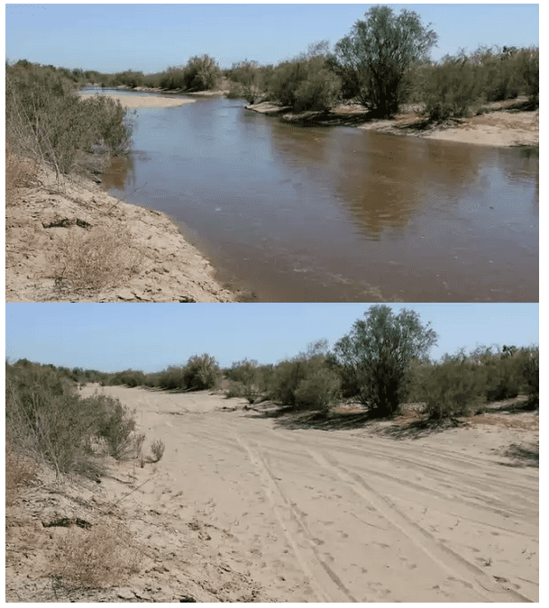
After and before images. Image via NASA.
The Colorado River stretches along 1,450-miles (2,330 km), encompassing seven US and two Mexican states. Known for its dramatic canyons and whitewater rapids, the Colorado river is also a vital source of water for agricultural and urban areas in the southwestern desert lands of North America. Recently, the river has been experiencing massive droughts due to over-utilization – 90% of the water is diverted in the US alone, not only for human and agricultural use, but also for electricity generation. Naturally, this over-usage has had a dramatic impact not only on the river itself, but also on the habitats it supports.
The year 2000 was the last time the Colorado River reached the Sea of Cortez, between Mexico’s mainland and Baja California. Since then, scientists reported that the water has never reached the sea, and the vegetation has been steadily decreasing in the area alongside the river. Satellite measurements were clear in highlighting the decline. But this spring pulse brought some of the green back. Pamela Nagler of the U.S. Geological Survey‘s Southwest Biological Science Center in Tucson, Arizona tracked the results, and there are some good news:
“The vegetation that desperately needed water was finally able to support more green leaves,” Nagler said. “These are existing trees, like saltcedar, willow and cottonwood, and a lot of shrubs and grasses that hadn’t seen much water in a long time.”

After the pulse flow, the lower Colorado River saw an increase in vegetation, as measured by the Normalized Difference Vegetation Index (NDVI) using Landsat 8 data. The left panel shows the NDVI before and after the pulse; the right panel shows the difference between the two measurements.
Image Credit: NASA’s Earth Observatory/J. Allen; NASA Goddard/M. Radcliff
When they compared the 2014 vegetation to the 2013 vegetation (prior to the pulse), the difference is huge – researchers calculated a 43 percent increase in green vegetation along the route wetted by the flow, called the inundation zone, and a 23 percent increase in greening of the riparian zone, or the river banks. These results were presented at the American Geophysical Union.
“Data from Landsat and the MODIS sensor are well-suited to help people make informed policy decisions about ecosystem health, water management, agriculture and much more,” said Jim Irons, Landsat 8 project scientist at NASA’s Goddard Space Flight Center in Greenbelt, Maryland. “It’s especially gratifying to see these sensors help scientists evaluate several of those components in one project,” he said.
Projects like this highlight the importance of having an archive of good Earth observations of the past to refer to, as well as comparable measurements into the future to measure how a policy changes the landscape. The fact that Minute 319 was successful is also a good sign.
“It’s important to have continuity of the data, so that when a policy decision is made to release the water, we have a system in place to evaluate its effects,” he said.
Remote sensing from satellites or technologies like LIDAR have revolutionized how we see the environment, and how we see the way we are impacting it. Basically, it allows us to view these things in a new way.
“Remote sensing with satellites such as Landsat and sensors such as MODIS allows scientists to conduct a range of studies they wouldn’t otherwise be able to,” said Karl Flessa, the co-chief scientist of the Minute 319 Science Team studying the hydrologic and biologic effects, and a geosciences professor at the University of Arizona in Tucson.
Other applications that this technology could have just for river monitoring includes detecting changes in the river channel, surface water, groundwater, plant growth, and habitat for resident marsh birds and migratory birds.
“In addition to remote sensing, ground-based geophysical methods such as time-lapse gravity maps provide information about the change in groundwater storage, which ultimately supports riparian vegetation,” said Jeff Kennedy, USGS hydrologist and participant in the study.
The project is also a reminder that different countries and organizations can and should work together when it comes to solving a problem which affects all the parties involved. Authorities are also considering repeating the experiment once more.
“There’s hope that we could release a pulse of water below Morelos Dam again,” Flessa said.