Beautiful map shows the mind-boggling extent of our underwater Internet cables
As we go around our daily lives with wireless internet and satellite smartphones, it's easy to forget that at the core of modern internet, there are hundreds of thousands of submarine cables lying on the ocean floor - sometimes at depths nearing 8,000 metres. Those cables help transmit 99 percent of all international data and without them, the world as we know it wouldn't exist - so let's give them a bit of credit.
As we go around our daily lives with wireless internet and satellite smartphones, it’s easy to forget that at the core of modern internet, there are hundreds of thousands of submarine cables lying on the ocean floor – sometimes at depths nearing 8,000 metres. Those cables help transmit 99 percent of all international data and without them, the world as we know it wouldn’t exist – so let’s give them a bit of credit.
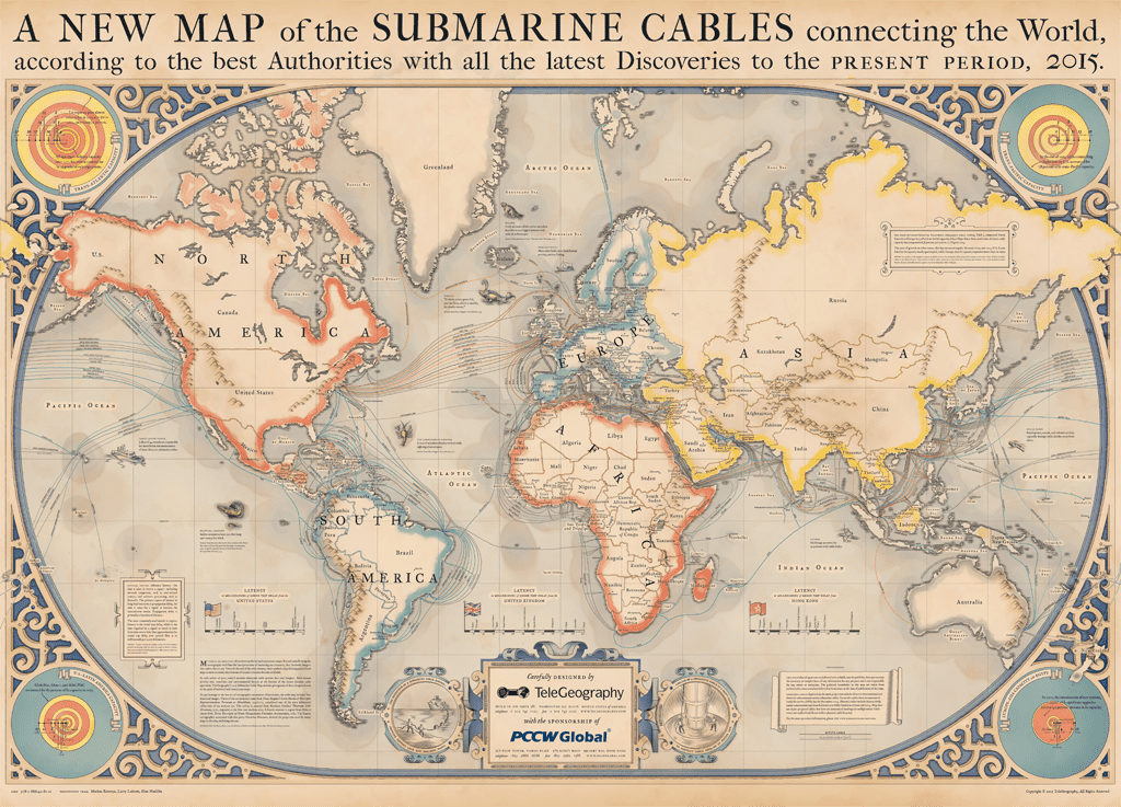
The Internet’s underwater cables (Credit: TeleGeography).
At the bottom of the map, you can also find information about “latency” at the bottom (how long it takes for information to transmit) and “lit capacity” in the corners (which shows how much traffic a system can send, usually measured in terabytes). You can browse a full zoomable version here.
TeleGeography, a US based telecommunications market research firm, has already created some impressive maps depicting these cable networks, but now, they’ve outdone themselves with the beautifully illustrated, vintage-themed map you see above.
Zooming in on the underwater cables. Image credits: TeleGeography.
“This year’s map pays tribute to the pioneering mapmakers of the Age of Discovery, incorporating elements of medieval and renaissance cartography,” the company states on its website. “In addition to serving as navigational aids, maps from this era were highly sought-after works of art, often adorned with fanciful illustrations of real and imagined dangers at sea. Such embellishments largely disappeared in the early 1600s, pushing modern map design into a purely functional direction.”
“To bring back the lost aesthetic that vanished along with these whimsical details, TeleGeography referenced a variety of resources in the design process,” they add. “One of the most invaluable was Chet Van Duzer’s Sea Monsters in Medieval and Renaissance Maps book, which provides arguably the most complete history of the evolution of sea monsters and map design from this period. Our final product is a view of the global submarine cable network seen through the lens of a bygone era.”
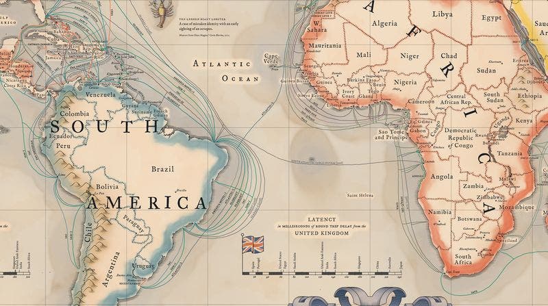
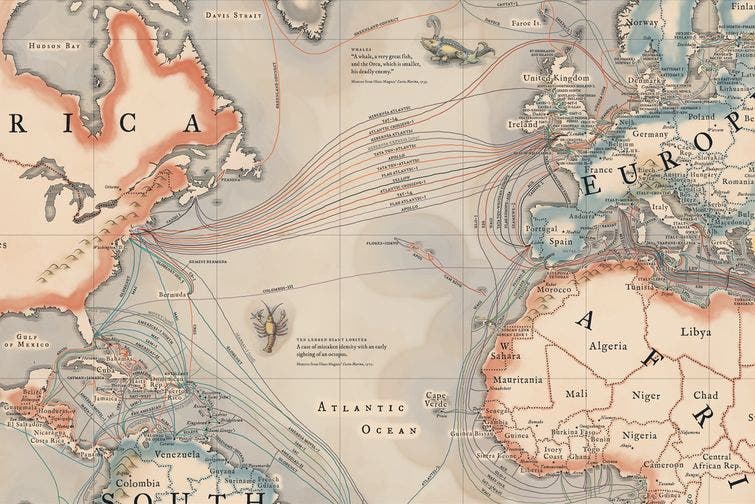
Connections in the South Atlantic are scarce. (Telegeography)
Indeed, it’s a bit humbling to think that despite all the advancements we see all around us, all the information on the internet relies on huge cables on the bottom of the sea. Modern cables are typically 69 millimetres (2.7 in) in diameter and weigh around 10 kilograms per metre (7 lb/ft), although thinner and lighter cables are used for deep-water sections. As of 2010, submarine cables link all the world’s continents except Antarctica.
We tend to think of cables as antique and modern satellites as the way to go today, but quite simply put, underwater cables are faster and more reliable.
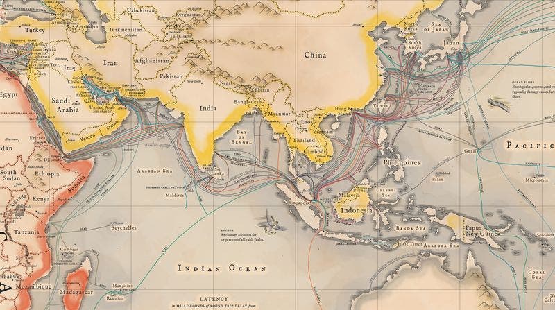
Submarine cables in Asia. (TeleGeography)
The first commercial submarine cables were laid in the 1850s. The first attempt at laying a transatlantic telegraph cable was promoted by Cyrus West Field, who persuaded British industrialists to fund and lay one in 1858. However, the technology of the day was not capable of supporting the project; it was plagued with problems from the outset, and was in operation for only a month. It took several decades for the technology to develop enough.
Today, the methodology for laying submarine cables hasn’t changed much in 150 years — a ship traverses the ocean, slowly unspooling cable that sinks to the ocean floor. It’s just that modern cables are thinner and more efficient.
So to sum it up, while admiring these beautiful maps, take a moment to consider that everything you see on the internet, from the crazy cat gifs to this article, you see thanks to these cables.

A cross section of a modern submarine communications cable.
1 – Polyethylene
2 – Mylar tape
3 – Stranded steel wires
4 – Aluminium water barrier
5 – Polycarbonate
6 – Copper or aluminium tube
7 – Petroleum jelly
8 – Optical fibers Image via Wiki Commons.


