Chinese rover on Mars finds not only evidence of water -- but evidence of flooding
It may be a desert now, but at some point in its history, Mars was flooded with water.
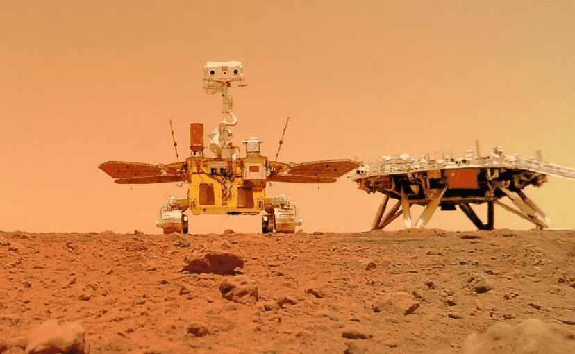
A few days ago, we wrote about the Perseverance rover’s subsurface-studying radar and how it’s enabling us to get a view of the Martian subsurface that’s better than ever. But that’s not the only radar on Mars. China’s Zhurong rover is also on the Red Planet, also equipped with a radar, and also showing us new things about Mars.
Radars on Mars work the same as the ones on Earth: they send an electromagnetic signal and then “listen” to the reflections. If you want to see what’s under the ground, you need a ground penetrating radar — which basically means you’re sending the signal directly down instead of up.
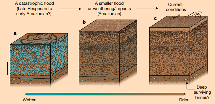
The signal propagates from the antenna and reflects back whenever it encounters a different structure. Now, researchers analyzing data from the Zhurong rover believe they’ve found signs suggestive of sediment that likely formed during catastrophic flooding that happened millions of years ago.
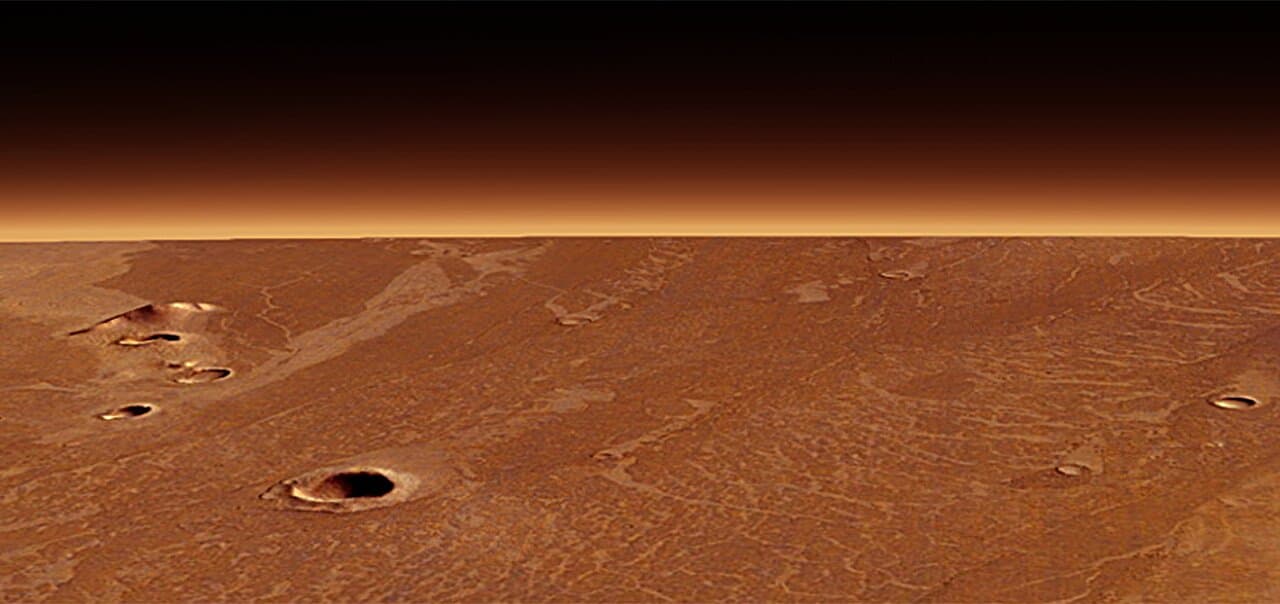
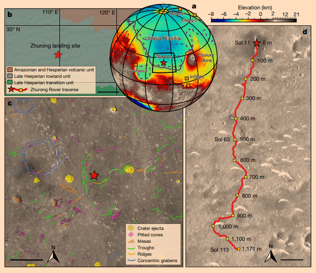
The rover landed in an area called Utopia Planitia, which is a part of the largest recognized impact basin on Mars and in the Solar System with an estimated diameter of 3300 km — one of the more interesting areas on Mars. In 2016, NASA reported finding a large amount of underground ice in the region, a volume equivalent to the water in Lake Superior.
But Utopia Planitia may have also hosted its own liquid water on the surface.
“Utopia Planitia, the smooth plains of volcanic and sedimentary strata that infilled the Utopia impact crater, has been a prime target for such exploration as it is inferred to have hosted an ancient ocean on Mars,” write the authors of the new study, led by Chao Li.
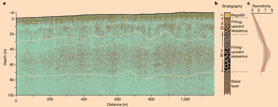
The rover traveled approximately 1,117 meters from its landing site, and radar data was gathered continuously over this distance.
The data doesn’t show any signs of any existing water in the first 70 meters of depth, but the data can’t rule out the existence of water below this depth.
But the study does document a layer between 30 and about 80 meters down that shows reflection signals that strengthen with increasing depth (as well as another layer with similar characteristics between 10 and 30 meters deep). Researchers interpret this as a layer with larger boulders at the bottom and smaller rocks settling on top.
This structure was interpreted as a layer formed as a result of rapid flooding that carried sediments to the region some three billion years ago, says co-author Chen Ling, a seismologist at the Institute of Geology and Geophysics, Chinese Academy of Sciences, in Beijing.
While there is a degree of speculation regarding the interpretation of the data (radar alone cannot tell materials apart by composition, only offer clues about structure), the study was generally well-received within the community.
“It’s quite spectacular for RoPeR to be able to look this deep with good resolution,” said Svein-Erik Hamran from the University of Oslo, who is principal investigator of the ground-penetrating radar RIMFAX on board Nasa’s Perseverance rover.
While many questions still remain about the internal structure of mars, having access to this type of data on site is offering a new understanding of the geology of the Red Planet. As more data comes in, this understanding will only improve.
The study was published in Nature, doi: https://doi.org/10.1038/d41586-022-03056-1.