Scientists Discover 9,000 Miles of Ancient Riverbeds on Mars. The Red Planet May Have Been Wet for Millions of Years
A new look at Mars makes you wonder just how wet it really was.
Looks like Mars might have had more water than anyone previously imagined.
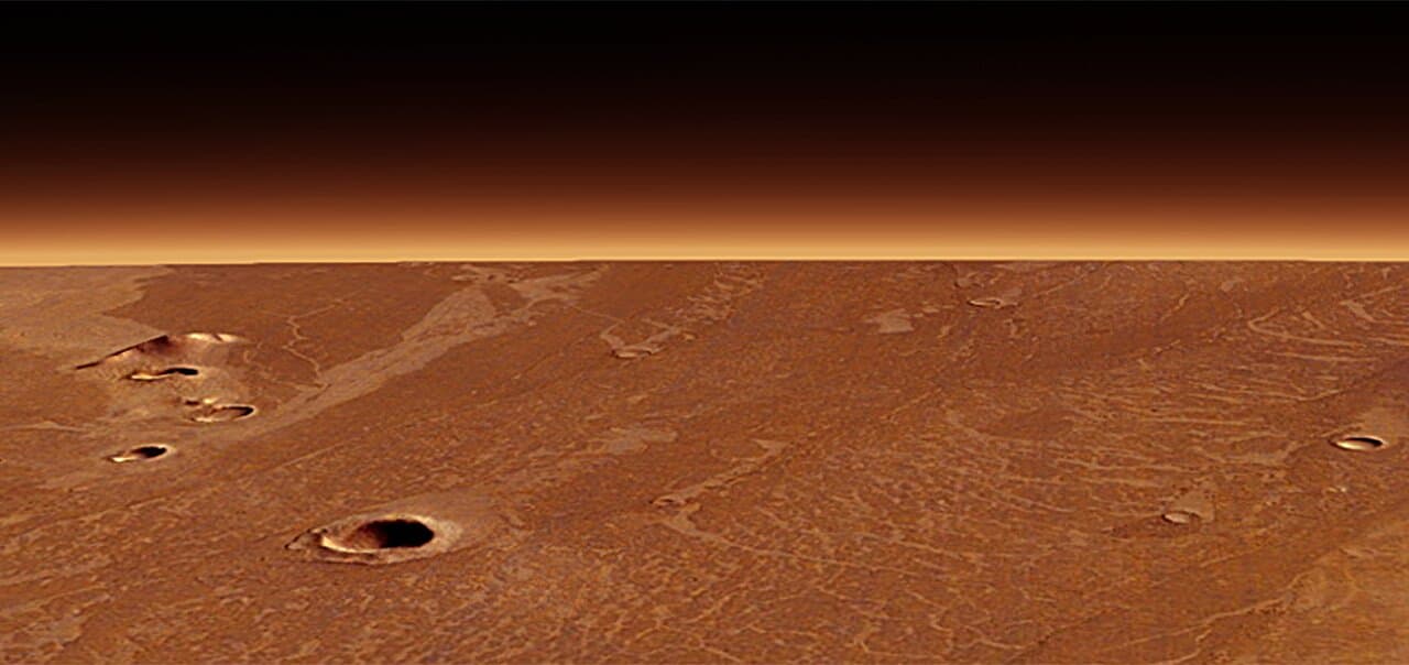
A sweeping orbital survey charted over 9,320 miles (15,000 kilometers) of riverbeds winding etched into Noachis Terra, a broad plateau in the planet’s southern highlands. Searching the fluvial sinuous ridges, also known as inverted channels, what they found suggests that the Red Planet may once have been much wetter than previously thought. Each ridge of the plateau is believed to have begun as a channel of flowing water; today the hardened sediment stands tens of meters above the plain, a lithic negative of vanished rivers.

Adam Losekoot, a doctoral researcher at the Open University, unveiled the map at the Royal Astronomical Society’s National Astronomy Meeting in Durham, England. Losekoot and colleagues stitched together Context Camera mosaics, Mars Orbiter Laser Altimeter profiles, and razor-sharp HiRISE (High Resolution Imaging Science Experiment) snapshots to trace every ridge finger across a region roughly the size of Spain.
“Studying Mars, particularly an underexplored region like Noachis Terra, is really exciting because it’s an environment which has been largely unchanged for billions of years,” Losekoot said. “It’s a time capsule that records fundamental geological processes in a way that just isn’t possible here on Earth.”
When water once coursed through these channels, sand and gravel settled onto the bed. Minerals bound the deposits into concrete-hard caps. Wind later scoured away softer surroundings, leaving the inverted relief that orbiters see today. Some ridges run for hundreds of kilometers without a break, while isolated fragments dot adjoining basins — clues that an entire drainage network once laced the landscape.
How did a landscape that once soaked up rain end up bone-dry? Most investigators point to the moment, roughly four billion years ago, when Mars’ global magnetic field sputtered out. Stripped of its shield, the planet faced the full force of the solar wind, which NASA’s Mars Atmosphere and Volatile Evolution (MAVEN) still clocks today stealing about 100 grams of gas every second — a petty theft that, over eons, emptied the tills. The thinning air dragged surface pressure below the triple point of water, so rivers either boiled away or flash-froze, and the ancient hydrological cycle collapsed.

The ridges date to the Noachian–Hesperian transition roughly 3.7 billion years ago, an era when Mars was shifting from a warmer climate to the cold desert preserved today. Their wide spread — and the fact that they sit in separate catchments rather than radiating from a single ice sheet — points to rainfall or snowfall as the water source. In other words, clouds gathered over Noachis Terra and rain fell often enough to keep rivers running for a geologically meaningful span.
The new catalogue contrasts sharply with traditional portrayals of early Mars as a frozen world punctuated only by brief meltwater pulses from volcanoes or asteroid impacts. A network this extensive implies a thicker atmosphere, a lively hydrological cycle, and surface conditions that stayed above freezing long enough for rivers to carve valleys and lay down sediments.
“Our work is a new piece of evidence that suggests that Mars was once a much more complex and active planet than it is now, which is such an exciting thing to be involved in,” said Losekoot. Future reconnaissance may zero in on cemented ridge tops that lock away ancient minerals, and perhaps organic clues, better than the dusty plains around them.