These Revolutionary Maps Are Revealing Earth's Geological Secrets
This work paves the way for more precise and comprehensive geological models
The Earth’s surface is a dynamic mosaic of geological features and tectonic activity, evolving over billions of years. Understanding this intricate interplay is crucial for unraveling the planet’s history and forecasting its future. A recent study marks significant progress in this quest, combining advanced geoscientific data and innovative technology to produce comprehensive maps offering unprecedented insight into Earth’s geological and tectonic architecture.
Tectonic shifts
Our Earth doesn’t just have one big, rigid shell, like an egg. Instead, the shell (which we call the crust) is split into several rigid plates. These are the tectonic plates.
Tectonic plates are also not fixed — they move around atop the mantle and are driven by convection currents of molten magma. Although their movement is imperceptibly slow—about the same rate as fingernail growth—over millions of years, they reshape continents and oceans in remarkable ways.
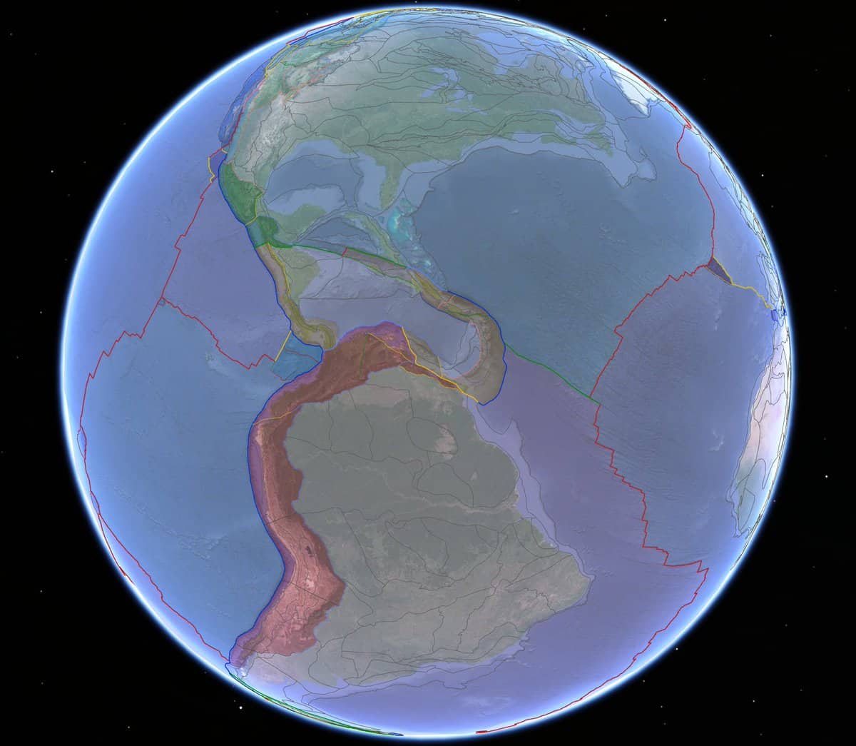
Earth’s surface has undergone dramatic transformations throughout its history. Once unified in the supercontinent Pangea, the landmasses later split into Laurasia and Gondwana before dispersing into the continents we know today. Fast forward another 100 million years, and Earth’s configuration will look entirely different once again.
Understanding the structural architecture and tectonic environment of Earth’s surface rocks, deeply intertwined with the chemical and physical traits of the lithosphere, is crucial for geoscientists.
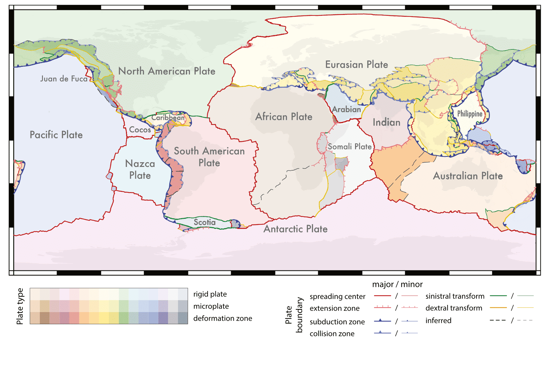
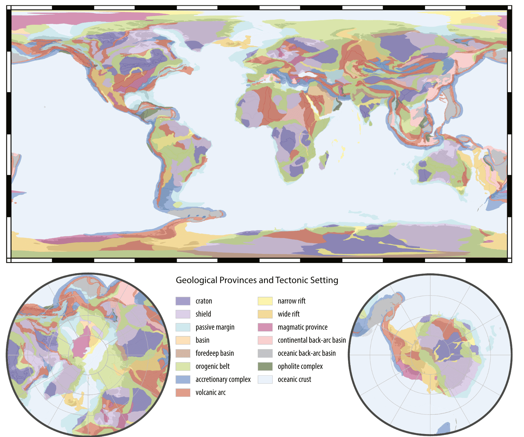
A groundbreaking study has unveiled a global compilation of tectonic plate boundaries and geological provinces, presented in a vector shapefile format. This detailed model integrates interpretive attributes such as crust type, plate type, province type, and the timing of the last orogeny. Such advancements promise to refine geoscientific analyses, offering deeper insights into the lithosphere’s composition and behavior.
Modelling plates
These global models stem from the integration of various geological, geochemical, and geochronological data. The researchers meticulously refined existing models using diverse constraints like GPS motions, earthquake data, mapped faults, and geochronology. This approach not only enhances the accuracy of plate and province boundaries but also captures the complex interplay of geological processes more effectively.
This information comes from various sources. The GPS motions come from several special observatories that accurately track how tectonic plates are moving one another. Geochronology refers to dating different plates — tectonic plates can get created or destroyed, so seeing how new or old one is can also provide information regarding its formation. Mapping faults and geological structures can also provide information about past evolution — and, by understanding this past evolution, we can project into the future.
“Accurate spatial models of tectonic plates and geological terranes are important for analyzing and interpreting a wide variety of geoscientific data and developing compositional and physical models of the lithosphere. We present a global compilation of active plate boundaries and geological provinces in a shapefile format with interpretive attributes (e.g., crust type, plate type, province type),” the study authors explain.
The study introduces two primary models:
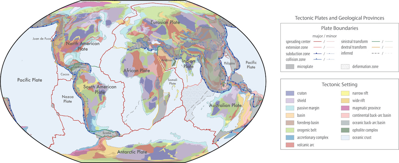
- Global Geologic Provinces: These are spatially accurate maps encompassing a uniform set of common geological characteristics, essential for comparative global studies and accurate plate reconstructions.
- Present-Day Plate Boundaries: This model improves upon existing models, incorporating attributes from geophysical, geochemical, and geochronological data. The aim is to extend tectonic boundaries back to approximately 2.3 billion years ago, integrating numerous geological interpretations and observations.
These models are poised to become a standard for classifying geological data across various databases. The models are freely available and open-source, allowing for continual updates and improvements from the geoscience community. This initiative fosters an adaptable and interactive environment, crucial for enhancing our understanding of Earth’s geological history, especially the Mesoproterozoic era and older periods.
A significant innovation is the transition from traditional raster maps to vector format shapefiles. This shift allows for seamless integration of geological data, offering a more nuanced understanding of Earth’s geological fabric. The vector format ensures that each polygon, line, or point can possess multiple unique attributes, enabling a detailed and multidimensional representation of geological features.
In essence, the work paves the way for more precise and comprehensive geological and tectonic models. This is a crucial step towards better predicting and understanding the Earth’s future.
These models are more than just static representations; they are dynamic tools that will continually evolve with contributions from the global scientific community. By making these resources open-source, the study not only democratizes access to high-quality geological data but also encourages collaborative efforts for further refinement and development.
The study was published in Earth Science Reviews.