NASA team to study Kilauea volcano from ground, air, and space
NASA's bringing out the big guns.
Kilauea is one of the world’s most iconic volcanoes and one that’s been thoroughly studied for decades. But even so, there’s still plenty we’ve yet to learn about the emblematic volcano, and about volcanoes in general. NASA’s approach is to tackle the volcano from all possible angles: from ground, air, and space. They hope that remote sensing could provide a trove of valuable information, especially regarding volcanic emissions and their transport.
NASA volcanoes
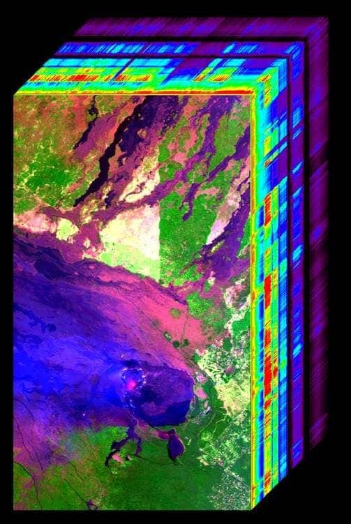
Imaging spectroscopy data of Hawaii’s Kilauea Volcano from NASA’s Airborne Visible/Infrared Imaging Spectrometer. Kilauea’s lava lake (orange) and ash plume (light blue) are visible in the lower center. The data are used to study lava temperature and properties, and ash and gas plume characteristics. Credit: NASA/JPL-Caltech
Kilauea is an active shield volcano in the Hawaiian Islands, and the most active of the five volcanoes that together form the island of Hawaiʻi. We’ve all seen it in pictures, and some have been lucky enough to see it in person, but Kilauea still keeps plenty secrets hidden. With this in mind, scientists from NASA, the USGS Hawaiian Volcano Observatory (HVO), Hawaii Volcanoes National Park, and several universities embarked on an epic six-week field campaign to study the links between volcanic gases/thermal emissions and vegetation health and extent. They also want to study the flow of lava from the volcanoes, thermal anomalies, gas plumes, other active volcanic processes, as well as ways to mitigate volcanic hazards. They’re also analyzing Hawaii’s coral reefs and their interaction with the volcano.
The on-site team will be complemented by NASA’s Hyperspectral Infrared Imager (HyspIRI) satellite mission, a new approach to studying Earth ecosystems. HyspIRI is basically an imaging spectrometer measuring from the visible to short wave infrared, providing critical information on natural disasters including volcanoes, wildfires, and drought. The imager can identify what type of vegetation is present and whether the vegetation is healthy or not. This will provide a benchmark on the state of the worlds ecosystems against which future changes can be assessed. The mission will also assess the pre-eruptive behavior of volcanoes and the likelihood of future eruptions as well as the carbon and other gases released from wildfires. So it’s not just about understanding Kilauea — the technology could be used in many places around the world.
“The data collected during the HyspIRI airborne campaign will advance our understanding of volcanic processes on Hawaii and elsewhere around the world,” said Ben Phillips, lead for NASA’s Earth Surface and Interior focus area, NASA Headquarters, Washington. “Such observations may inform future decisions by volcano hazard responders and regulatory agencies.”
The imager will be carried by a Lockheer ER-2 aircraft flying at 65,000 feet (19,800 meters), above 95 percent of Earth’s atmosphere, replicating the data that would come from a satellite (NASA hope to develop all this into a satellite in the future). The ER-2 will carry other type of sensors as well, including an Airborne Visible and Infrared Imaging Spectrometer (AVIRIS) and the MODIS-ASTER Airborne Simulator (MASTER). Another aircraft will carry JPL’s Glacier and Land Ice Surface Topography Interferometer (GLISTIN) instrument, which will collect high-resolution data to measure topographic changes from new Kilauea lava flows.
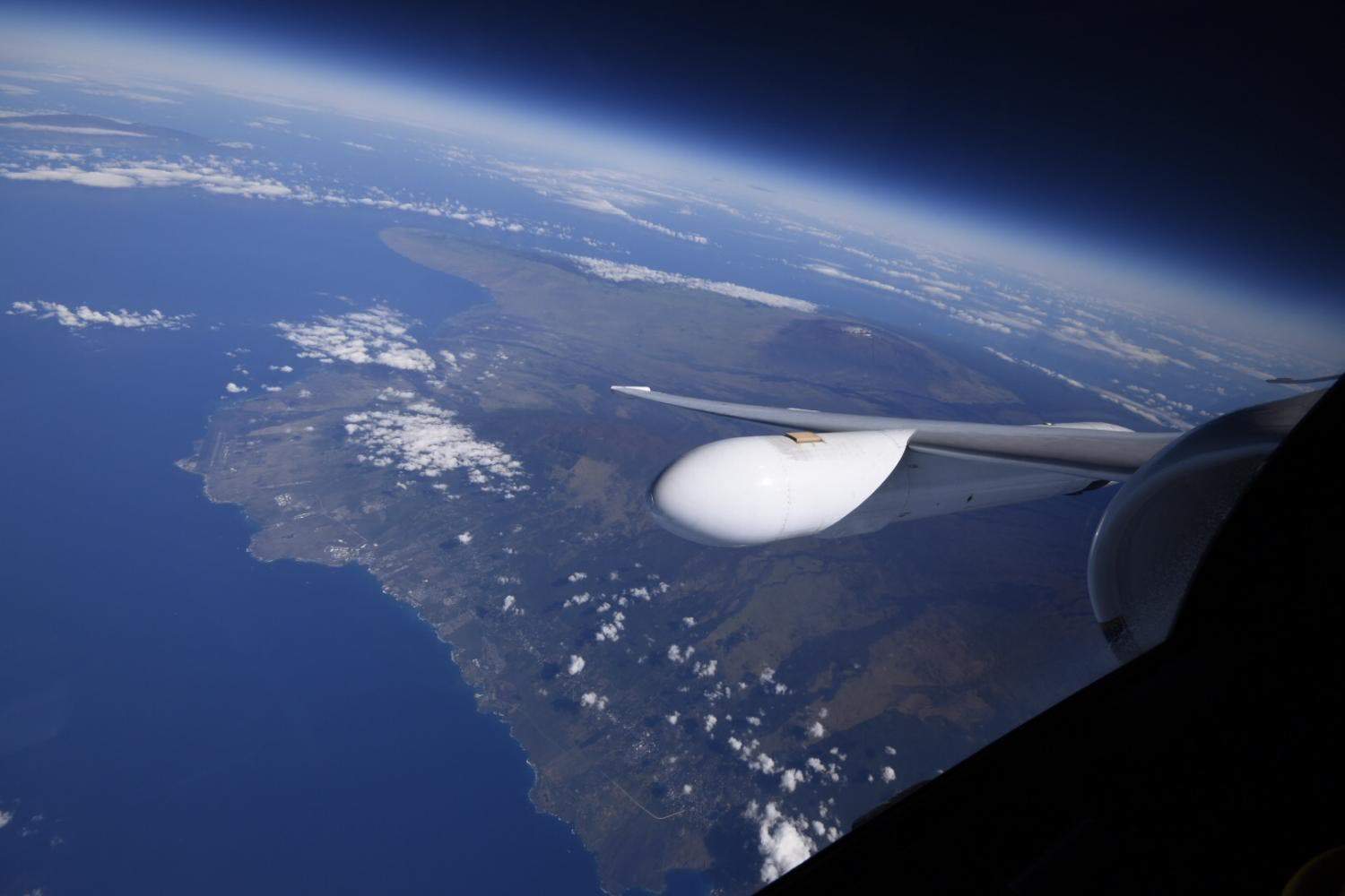
Beautiful view of the island of Hawaii from the window of NASA’s ER-2 aircraft. Credits: NASA
Volcano emissions
Kilauea has been in a constant eruption limbo for centuries, constantly spewing lava with some breaks in between. When it started erupting again in 2008, it also started emitting dramatic levels of sulphur dioxide. What NASA wants to study now is the so-called vog — a dangerous type of volcanic air pollution present across much of Hawaii. Using MASTER and AVIRIS, the team plans to study Kilauea’s releases of heat and gas, mapping the composition and chemical evolution of its gas plumes.
Vog is a form of air pollution that results when sulfur dioxide and other gases and particles emitted by an erupting volcano react with oxygen and moisture in the presence of sunlight. The data is expected to help researchers better understand how quickly sulfur dioxide morph into aerosols, creating maps of how this rate varies from area to area. These maps will then be used to forecast the development of vog and develop evolution models.
Volcanic emissions also affect the health of plants in the volcano’s proximity, and the health and extent of vegetation near volcanoes might signal impending eruption, but this is insufficiently studied at the moment. Detecting and characterizing the effect the eruption has on plants could provide another proxy, another indirect indication of what’s happening to a volcano. The NASA team is also looking at thermal anomaly detection (which might also precede an eruption), measuring changes in lava flow volume, and ways to improve estimates of volcano thermal data. All in all, it’s a trove of scientific data, and one which might prove vital for our understanding of volcanic eruptions.


