Archaeologists find ancient Roman camps in the Arabian Desert using Google Earth
The fortified camps were likely staging areas for an undocumented military campaign against an ancient kingdom in modern-day Jordan.
A lot of people like to “travel” to various off-the-beaten-track destinations around the world using Google Earth, all from the comfort of their living room thousands of miles away from the actual “destination”. You can explore Venice’s amazing canals, China’s Great Wall, or Manhattan’s busy streets. Granted, it’s not the same as actually being there in person, but it helps to keep the wanderlust spirit in check.
But Google Earth is useful for more than digital tourism and geography lessons. It can also be a fantastic tool for doing remote archaeology.
Hidden history beneath the sands
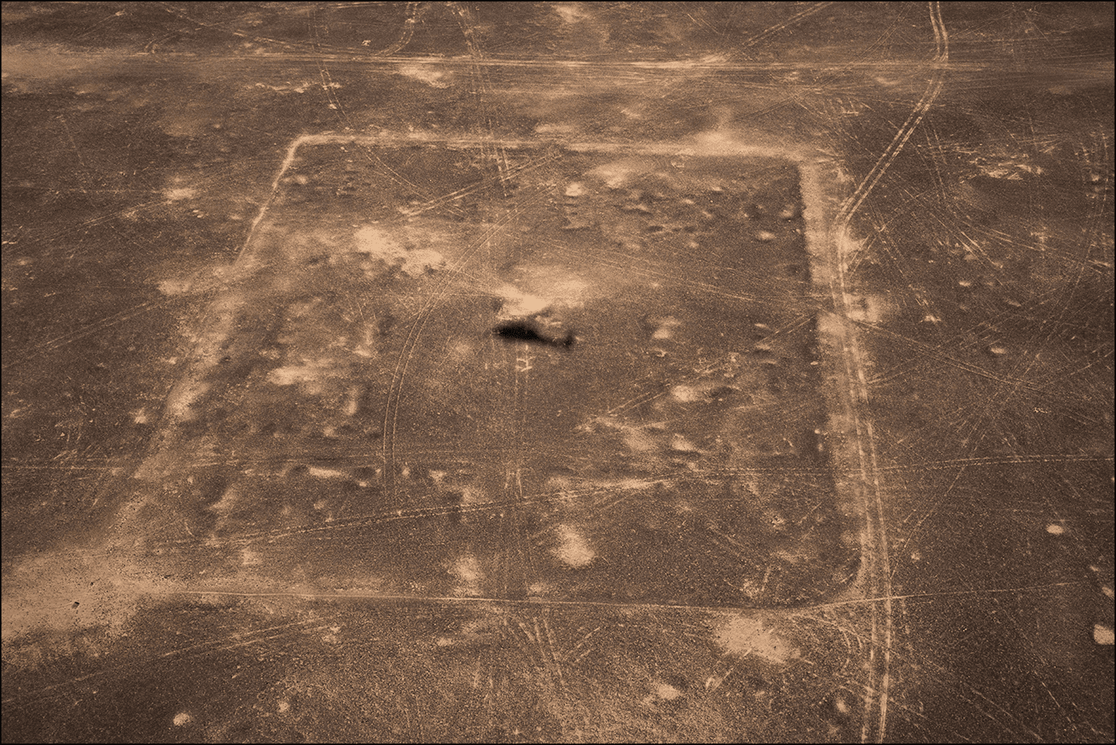
Case in point, researchers at the University of Oxford’s School of Archaeology used open and free Google Earth satellite imagery to uncover three abandoned Roman camps in Arabia, which seem to date from the 2nd century AD.
According to the researchers, the military camps may have been used by the Romans during a campaign against the Nabataean Kingdom, which is located in Jordan and centered around the world-famous city of Petra.
Dr. Michael Fradley, who led the research, says these camps were likely built by the Roman army, given the characteristic playing card shape of the enclosures with opposing entrances along each side.
The westernmost camp is significantly larger than the two camps to the east, and the distance between each camp ranges from 37 km to 44 km. This spacing suggests the camps were built by a cavalry unit that could travel over such barren terrain in a single day, possibly on camels.


What was the Nabataean Kingdom?
The Nabataean Kingdom was an ingenious civilization that managed to thrive in the harshest of environments. They were a nomadic people who traveled with their livestock throughout the Arabian Peninsula.
But they were also savvy traders who were able to establish a vast network of trade routes that spanned from India to Rome. This network allowed the Nabataeans to trade in spices, incense, and other luxury goods, which made them incredibly wealthy.
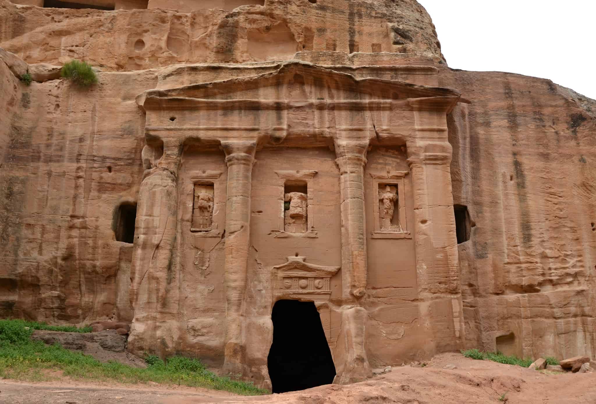
At the center of this trade network was the city of Petra, which was carved into the sandstone cliffs and adorned with towering façades, temples, and tombs with the proceeds of this lucrative business.
Yet the Nabataeans may have been too successful for their own good. The glitter of the jewel that was Petra attracted envious eyes, including those of the insatiable Romans.
The Nabataean Kingdom was annexed by the Roman Empire under Emperor Trajan in 106-107 AD, becoming the province of Arabia Petraea. According to surviving Roman documents, this annexation occurred peacefully, leading us to believe the Nabataean surrendered without a fight, finding themselves surrounded by the enemy which, by that time, controlled neighboring Egypt, Syria, and Judea.

But if that’s the case why were these newly found camps built? Professor Andrew Wilson, a co-author of the paper, believes that these outposts suggest that the Roman annexation of the Nabataean Kingdom following the death of the last king, Rabbel II Soter in AD 106, was not an entirely straightforward affair and that Rome moved quickly to secure the kingdom.
The level of preservation of the camps is remarkable, given that they may have only been used for a matter of days or weeks. The camps went along a peripheral caravan route linking Bayir and Dûmat al-Jandal, suggesting a strategy to bypass the more used route down the Wadi Sirhan and add an element of surprise to the attack.
If that is the case, this means the digitally discovered archaeological sites are revealing a previously unknown chapter of Roman history.
However, there are still questions that need to be answered. For instance, why does the western camp have twice the capacity of the other two? Did the force split, and if so, where did the other half go? Was it half wiped out in a battle, or did they remain in the western camp to resupply the other camps with water?
Despite the unanswered questions, this discovery has shed new light on Roman history, and how they acquired provinces. While Roman forts and fortresses show how Rome held a province, temporary camps reveal how they acquired it in the first place.
“Future fieldwork could potentially confirm some of these initial interpretations, particularly if material could indicate the period in which the camps were built and occupied. Further investigation in the southern Wadi Sirhan and in the vicinity of Dûmat al-Jandal might also add to our understanding of the Roman army operating in this region,” the researchers wrote.
What’s more, this find is not only of significant historical importance, but also a testament to the marvels of modern technology. Who would have thought that Google Earth could reveal evidence of a previously undocumented military campaign by the Romans? It just goes to show that there are still hidden secrets waiting to be uncovered.
The new findings appeared in the journal Antiquity.