Watch all the volcanoes and earthquakes since 1960 hit around the world in one app
A stunning app put together by Smithsonian's Global Volcanism Project.
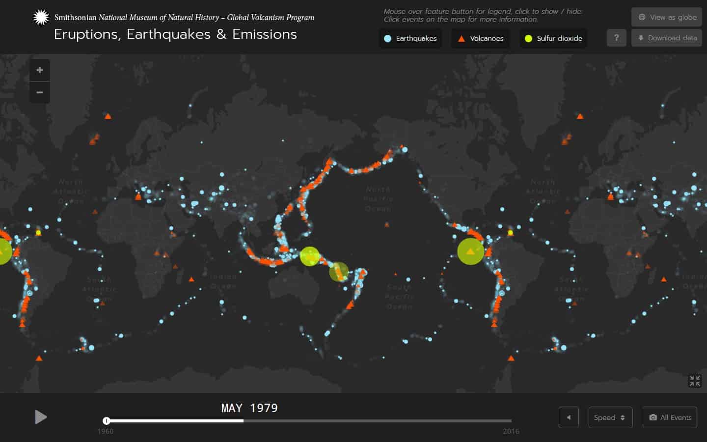
The Global Volcanism Program has released an interactive map showing the three big E’s (earthquakes, eruptions, emissions) since 1960.
And it looks like this.
Image credits Global Volcanism Program.
For something literally set in stone, Earth’s crust is far from inactive.
The relatively thin layer of solid rock covering the planet is fractured into tectonic plates, which move relative to each other — bending, pushing, crashing together. This constant motion creates rifts, huge chasms in the crust where magma boils up to the surface to create new rock, and subduction zones where rocks sink and are melted down into fresh magma.
Tectonic processes release huge amounts of energy and matter, creating earthquakes and powering volcanism. Now, for the first time, a global visualization (link to app) of seismic and volcanic data lets us see the effects of the crust’s constant movements. The map was created by the Global Volcanism Program at the Smithsonian’s National Museum of Natural History, with data from the USGS and NASA. It tracks every recorded volcanic eruption (red triangle) and earthquake (blue circle) since 1960. Starting from 1978, satellite UV monitoring allowed scientists to pick up on sulfur dioxide emissions (yellow circle) in the atmosphere. You can see all the events at once, or let them add up as time passes. Clicking on eruptions after 1978 lets you watch it’s sulfur clouds appear and dissipate.
And, if you take the final image of E3s and stack them over a tectonic map, you’ll see just how well they stack with the edges of plates. Volcanoes, in particular, tend to follow their outlines — the ones inland usually revolve around hotspots such as those in Iceland, Indonesia, the Aleutian islands and the tip of South America. Earthquakes farther from the outlines are usually formed around fault or fault systems, or may simply be tremors.


