Google Earth's new feature: a timelapse of the entire planet
It's one of the most stunning features we've seen online.
What if you could take the entire planet, gather over 30 years of satellite data on it, and put it all together into a simple app that can even be used on your smartphone? Well… that’s exactly what Google recently unveiled. The new features for its Timelapse allow users to zoom in on any locations they choose, viewing more than three decades of imagery.
The world at our fingertips
It’s true that we now have the entire planet at our fingertips in more ways than one. Even some 20-30 years ago, most people would have had a hard time imagining this. The fact that you can use a common device most of us carry in our pockets and zoom in over any corner of the Earth and see how it evolved in the past few decades speaks a lot to how much technology and scientific observation have progressed.
You can browse your hometown, your favorite forest, a glacier, anything — in some areas, data is better than in others, but you can see a timelapse of every corner of the globe.
“In the biggest update to Google Earth since 2017, you can now see our planet in an entirely new dimension — time. With Timelapse in Google Earth, 24 million satellite photos from the past 37 years have been compiled into an interactive 4D experience. Now anyone can watch time unfold and witness nearly four decades of planetary change,” wrote Rebecca Moore, director of Google Earth, Earth Engine and outreach.
But the Google Timelapse feature also offers a sobering look at how much we are changing the planet.
Location after location, it’s the same story: the impact of mankind is changing the planet, whether directly (through deforestation, river management, building cities, etc), or indirectly (through climate change).
“Our planet has seen rapid environmental change in the past half-century — more than any other point in human history. Many of us have experienced these changes in our own communities,” Moore wrote.
More than just being eye candy (though it definitely is), Google’s project could help researchers interpret satellite data more easily, and could help citizen scientists find trends in their own communities.
Several recent studies suggest that time lapses are actually become useful tools for research, and the data could come in handy particularly in areas where local monitoring data is sparse.
To put this all together, Google used data from both U.S. Geological Survey/NASA Landsat satellites, as well as the EU’s Copernicus Program and its Sentinel series of satellites. They also worked with Carnegie Mellon University’s CREATE Lab, which helped to process and display the approximately 10 quadrillion pixels in this database.
“More than two million processing hours across thousands of machines in Google Cloud to compile 20 petabytes of satellite imagery into a single 4.4 terapixel-sized video mosaic,” Moore explains — a process that used 100% renewable energy, in line with Google’s objectives to cut its own emissions.
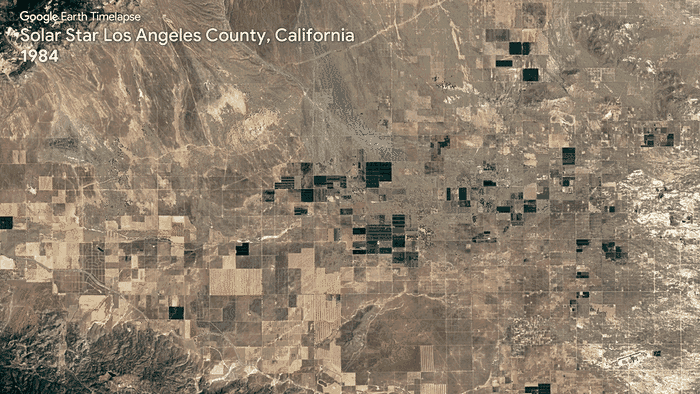
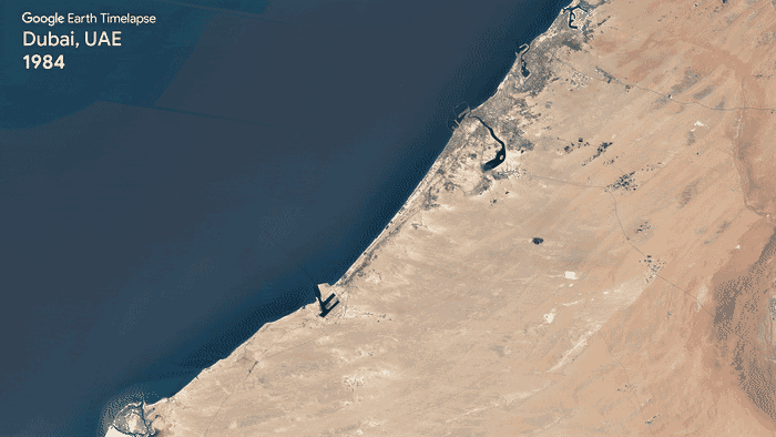
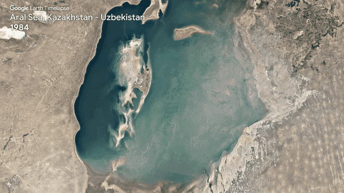
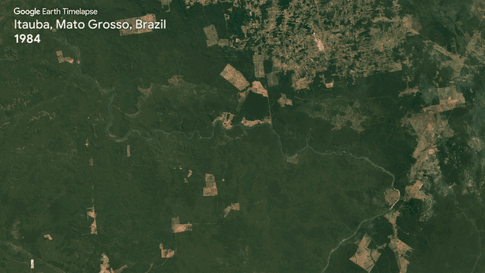
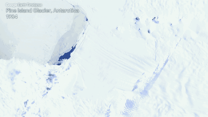
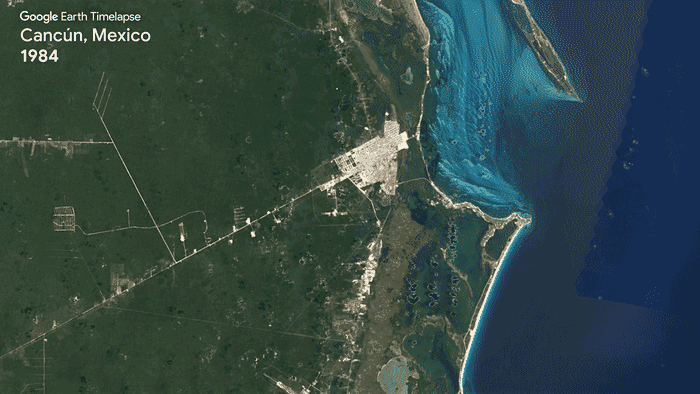
Here’s a list of some of the most stunning timelapses (full engine here).


