From Titanic to AI-tanic: AI shatters speed barriers in iceberg surveillance
The new program can map an iceberg quicker than you can blink.
In the time it takes to say “Titanic,” a newly developed AI system can have already mapped an outline of an iceberg. Anne Braakmann-Folgmann and her University of Leeds research team have created an AI that promises to revolutionize the approach to environmental monitoring, processing data at a speed 10,000 times faster than human analysts
This major advance outstrips previous automated systems, often mistaking icebergs for sea ice or the nearby coastline. Not only that but in the time it takes to exhale, the new program maps an area the size of a small country. In one-hundredth of a second, the AI can delineate the surface area and outline of icebergs with meticulous precision. While the human analysis was previously more accurate, the process was a time-consuming and laborious affair.
This represents a significant leap from earlier attempts at automation, which often confused icebergs with other features.
Artificial intelligence, real mapping
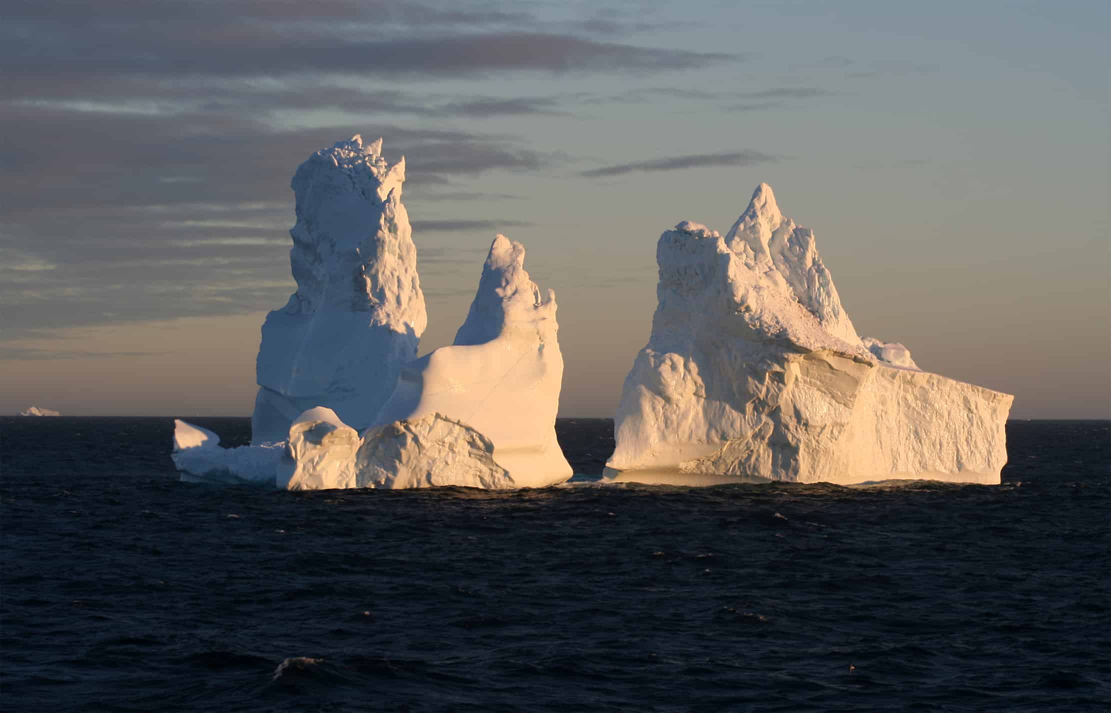
The polar environment is dynamic and ever-changing. Icebergs, sometimes as large as sovereign territories, drift through icy waters, presenting both hazards for maritime navigation and, since icebergs release nutrients and freshwater into the seas, can significantly impact marine ecosystems as they melt. The speed at which the AI operates allows for near-instantaneous mapping, crucial for maritime safety and the scientific study of these frozen leviathans.
“Icebergs exist in hard-to-reach parts of the world and satellites are not only a fantastic tool to observe where they are, they can help scientists understand the process of how they melt and eventually begin to break apart,” said Braakmann-Folgmann, who led the study while undertaking doctoral research at the Centre for Polar Observation and Monitoring at the University of Leeds.
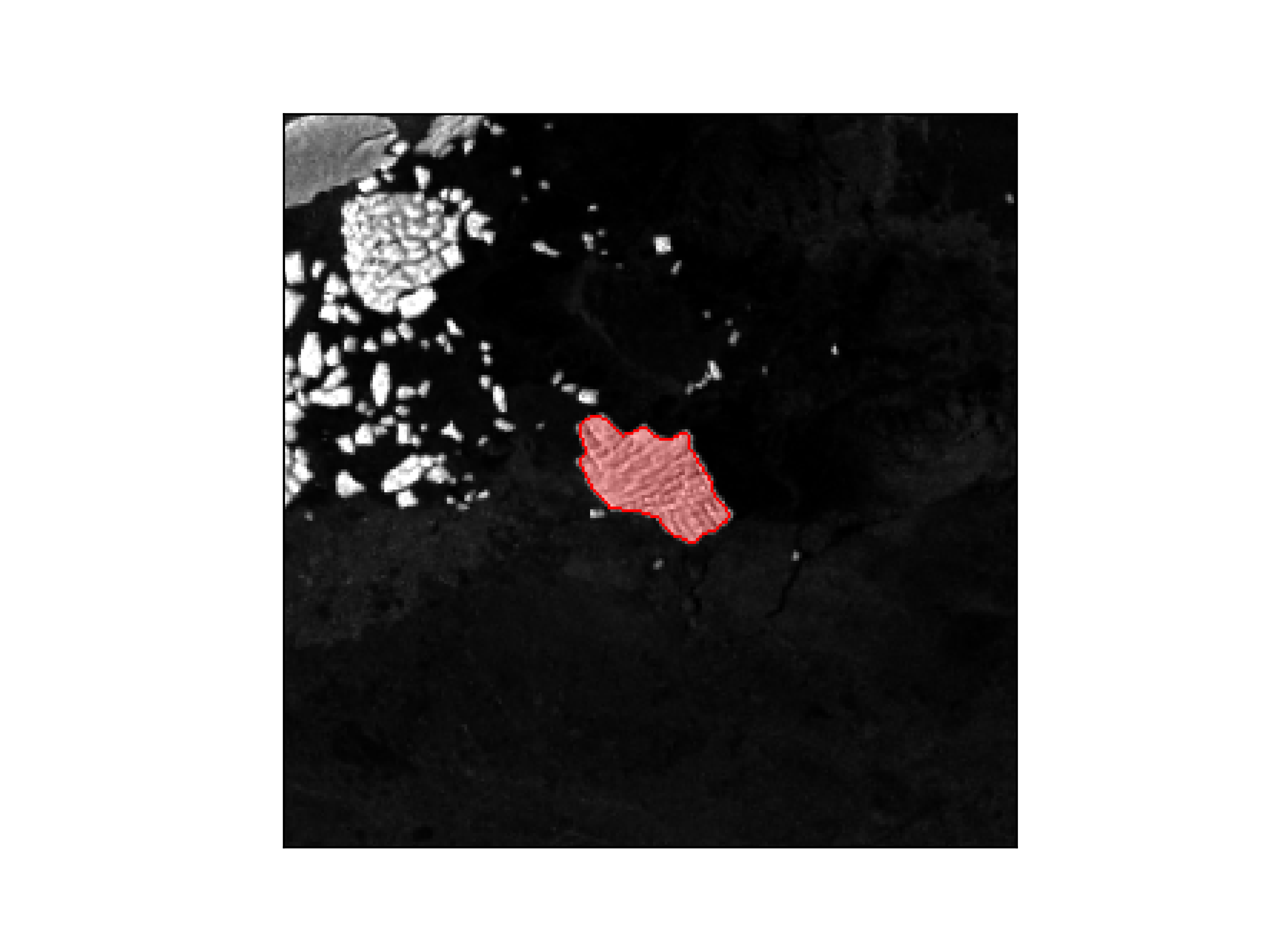
Braakmann-Folgmann and her colleagues used an algorithm called U-net – a type of neural network — to “train” a computer to accurately map the outline of icebergs from images taken by Sentinel-1 satellites operated by the European Space Agency. It is set to underpin new services that provide comprehensive data about iceberg shapes and sizes. This is a significant upgrade from current mapping services, which mark only the midpoint or central location of these ice giants. With such rapid interpretation, the outlines and areas of icebergs can now be calculated and provided to ships and research stations in real-time.
“Being able to automatically map iceberg extent with enhanced speed and accuracy paves the way for an operational service providing iceberg outlines on a regular, automated basis,” said Braakmann-Folgmann, now based at the Arctic University of Norway in Tromsø. “Combining them with measurements of iceberg thickness, also enables scientists to monitor where giant icebergs are releasing vast quantities of freshwater into the oceans. There are services that give data on the location of icebergs – but not their outline or area.”
Sprinting forward
Moreover, the technology’s efficiency and speed mean that it could support an operational service, offering regular, automated iceberg outlines. This is not just a step but a sprint forward in environmental monitoring, providing essential data with the speed and accuracy needed for effective decision-making.
The U-net’s performance has consistently shown only a minimal underestimation in icebergs, while other algorithms inflated their estimates massively by including sea ice and land in their calculations.
The research found for every minute spent mapping icebergs manually, the AI system could have processed 600,000 images. This isn’t just about saving time; it’s about amplifying capabilities to monitor and protect the world’s most remote and inaccessible regions.
“This study shows that machine learning will enable scientists to monitor remote and inaccessible parts of the world in almost real-time,” said Andrew Shepherd, professor at the University of Northumbria and co-author of the study. “And with machine learning, the algorithm will become more accurate as it learns from errors in the way it interprets a satellite image.”
As we witness the burgeoning capabilities of AI in the realm of environmental science, it’s clear that the future of our planet’s monitoring and protection lies in the realm of the digital revolution. The AI’s ability to map icebergs at such unprecedented speed is more than a technological accomplishment — it’s a paradigm shift in environmental monitoring.
The paper entitled “Mapping the extent of giant Antarctic icebergs with Deep Learning” was published in the journal The Cryosphere.


